Bagolino
| ||||
| ||||
 | ||||
| Państwo | ||||
| Region | Lombardia | |||
| Prowincja | Brescia | |||
| Kod ISTAT | 017010 | |||
| Powierzchnia | 109 km² | |||
| Populacja (2004) • liczba ludności | 3919 | |||
| • gęstość | 36 os./km² | |||
| Numer kierunkowy | 0365 | |||
| Kod pocztowy | 25072 | |||
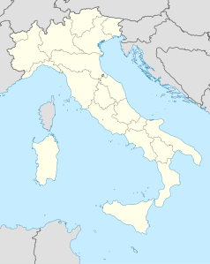
Bagolino – miejscowość i gmina we Włoszech, w regionie Lombardia, w prowincji Brescia.
Według danych na rok 2004 gminę zamieszkiwało 3919 osób, 36 os./km².
Linki zewnętrzne
- Strona gminy
- Źródło danych: Istituto Nazionale di Statistica
Kontrola autorytatywna (gmina we Włoszech):
Media użyte na tej stronie
Italy location map.svg
Autor: NordNordWest, Licencja: CC BY-SA 3.0
Location map of Italy (Commons photos) → en-Wikipedia Italy.
Autor: NordNordWest, Licencja: CC BY-SA 3.0
Location map of Italy (Commons photos) → en-Wikipedia Italy.
Bagolino village.jpg
Autor: Autor nie został podany w rozpoznawalny automatycznie sposób. Założono, że to Manfred Heyde (w oparciu o szablon praw autorskich)., Licencja: CC-BY-SA-3.0
Village of Bagolino, located near Lake Garda in the province of Brescia/Italy
Autor: Autor nie został podany w rozpoznawalny automatycznie sposób. Założono, że to Manfred Heyde (w oparciu o szablon praw autorskich)., Licencja: CC-BY-SA-3.0
Village of Bagolino, located near Lake Garda in the province of Brescia/Italy
Blason ville it Bagolino.svg
Autor: SanglierT, Licencja: CC BY-SA 3.0
D'azur, à trois monts de sinople, les monts latéraux mouvant de la pointe, celui de dextre masquant partiellement celui de senestre, tous deux masquant partiellement le mont central plus haut, sommé d'une croix latine aux branches pattées d'or.
Autor: SanglierT, Licencja: CC BY-SA 3.0
D'azur, à trois monts de sinople, les monts latéraux mouvant de la pointe, celui de dextre masquant partiellement celui de senestre, tous deux masquant partiellement le mont central plus haut, sommé d'une croix latine aux branches pattées d'or.


