Bakersfield (Kalifornia)
| |||||
 | |||||
| Państwo | |||||
|---|---|---|---|---|---|
| Stan | |||||
| Hrabstwo | |||||
| Data założenia | 1869 | ||||
| Kod statystyczny | |||||
| Burmistrz | Karen Goh | ||||
| Powierzchnia | 371,946 km² | ||||
| Wysokość | 123 m n.p.m. | ||||
| Populacja (2010) • liczba ludności • gęstość |
| ||||
| Nr kierunkowy | 661 | ||||
| Kod pocztowy | 93301 – 93314 | ||||
| Strefa czasowa | |||||
| Strona internetowa | |||||
| Portal | |||||
Bakersfield – miasto w zachodniej części Stanów Zjednoczonych, w Kalifornii, w hrabstwie Kern, około 180 km na północny zachód od Los Angeles. Z tego miasta wywodzą się znane zespoły gatunku nu metal takie jak Korn czy Adema.
Miasto liczy 247,1 tys. mieszkańców, a jego oficjalny obszar metropolitalny (hrabstwo Kern) 661,6 tys. mieszkańców (2000).
W mieście rozwinął się przemysł chemiczny, spożywczy oraz rafineryjny[1].
Miasta partnerskie
 Białoruś: Mińsk
 Japonia: Wakayama
 Chińska Republika Ludowa: Cixi
 Meksyk: Querétaro
 Korea Południowa: Bucheon
Przypisy
- ↑ Bakersfield, [w:] Encyklopedia PWN [online] [dostęp 2021-05-31].
Media użyte na tej stronie
Autor: NordNordWest, Licencja: CC BY 3.0
Location map of California, USA
Autor: Uwe Dedering, Licencja: CC BY-SA 3.0
Location map of the USA (without Hawaii and Alaska).
EquiDistantConicProjection:
Central parallel:
* N: 37.0° N
Central meridian:
* E: 96.0° W
Standard parallels:
* 1: 32.0° N
* 2: 42.0° N
Made with Natural Earth. Free vector and raster map data @ naturalearthdata.com.
Formulas for x and y:
x = 50.0 + 124.03149777329222 * ((1.9694462586094064-({{{2}}}* pi / 180))
      * sin(0.6010514667026994 * ({{{3}}} + 96) * pi / 180))
y = 50.0 + 1.6155950752393982 * 124.03149777329222 * 0.02613325650382181
      - 1.6155950752393982  * 124.03149777329222 *
     (1.3236744353715044  - (1.9694462586094064-({{{2}}}* pi / 180))
      * cos(0.6010514667026994 * ({{{3}}} + 96) * pi / 180))
The flag of Navassa Island is simply the United States flag. It does not have a "local" flag or "unofficial" flag; it is an uninhabited island. The version with a profile view was based on Flags of the World and as a fictional design has no status warranting a place on any Wiki. It was made up by a random person with no connection to the island, it has never flown on the island, and it has never received any sort of recognition or validation by any authority. The person quoted on that page has no authority to bestow a flag, "unofficial" or otherwise, on the island.
Flag of California. This version is designed to accurately depict the standard print of the bear as well as adhere to the official flag code regarding the size, position and proportion of the bear, the colors of the flag, and the position and size of the star.
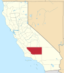
Locator map showing Kern County — in central and southern California.
Autor: Bobak Ha'Eri, Licencja: CC BY-SA 2.5
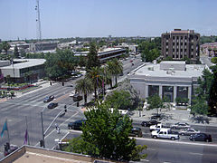
Bakersfield, California, USA. City Hall and Police Headquarters at left and Hall of Records at right.


