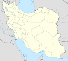
Bandar-e Emam Chomejni
 | |
| Państwo | |
|---|---|
| Ostan | |
| Populacja (2011) • liczba ludności |
|
Bandar-e Emam Chomejni (perski: بندرامام خمینی, do 1979 roku Bandar-e Szahpur) – miasto w południowo-zachodnim Iranie, w ostanie Chuzestan, nad Zatoką Perską.
W 2011 miejscowość liczyła 72 357 mieszkańców. Dla porównania, w 2006 było ich 67 467, w 1966 – 55 936, a w 1970 – około 24 tys. Port handlowy. Rozwinięte rybołówstwo. W mieście znajduje się południowe zakończenie Kolei Transirańskiej[1].
Przypisy
- ↑ Encyklopedia Powszechna PWN. T. 1. A-F. Warszawa: Państwowe Wydawnictwo Naukowe, 1974, s. 203.
Media użyte na tej stronie
While most of the image shows water and land that is relatively untouched by human activity, the inset image below offers a more detailed view of the Bandar Imam Khomeini petrochemical complex, Iran’s largest supplier of petrochemicals to the international market. The refining facilities produce a wide variety of petroleum-based products that are turned into gasoline and other fuels, plastics, fertilizers, and industrial chemicals. While the main port complex lies just out of the scene, several docks are visible
Since several petrochemical facilities release wastewater and oil tankers frequently discharge ballast water, the bay is thought to contain high levels of oil residue, tar balls, and other heavy metals. To quantify pollution levels, several groups of scientists have analyzed sediment collected from Musa Bay for signs of polycyclic aromatic hydrocarbons (PAHs) and other pollutants. Several of these studies detect pollutants at high enough levels that they could affect the ecosystem. However, pollution levels were not found to be abnormally high in comparison to other petrochemical facilities around the world.
ReferencesAbdohhahi, S. et al, (2013, June 15) Contamination levels and spatial distributions of heavy metals and PAHs in surface sediment of Imam Khomeini Port, Persian Gulf, Iran. Marine Pollution Bulletin, 71 (1-2).
Autor: Uwe Dedering, Licencja: CC BY-SA 3.0
Location map of Iran.
Equirectangular projection. Stretched by 118.0%. Geographic limits of the map:
* N: 40.0° N
* S: 24.5° N
* W: 43.5° E
* E: 64.0° E
Made with Natural Earth. Free vector and raster map data @ naturalearthdata.com.


