Banjarbaru
| Ten artykuł od 2014-04 wymaga zweryfikowania podanych informacji. |
| |||
 | |||
| |||
| Państwo | |||
| Prowincja | |||
| Strona internetowa | |||
Banjarbaru – miasto w Indonezji w południowej części wyspy Borneo, w prowincji Borneo Południowe.
Powierzchnia 371.3 km²; 135 tys. mieszkańców (2005).
Linki zewnętrzne
Media użyte na tej stronie
Autor: Uwe Dedering, Licencja: CC BY-SA 3.0
Location map of Indonesia.
Equirectangular projection. Stretched by 100.0%. Geographic limits of the map:
- N: 6.5° N
- S: -11.5° N
- W: 94.5° E
- E: 141.5° E
bendera Indonesia
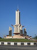
Welcome monument to Banjarbaru City, South Kalimantan, Indonesia.
Lambang Provinsi Kalimantan Selatan
Lambang (Coat of Arms) of Kota (City) Banjarbaru, Provinsi Kalimantan Selatan (South Kalimantan Province, on island Borneo/Kalimantan in id), Indonesia


