Barbacena
| |||||
 | |||||
| Państwo | |||||
| Stan | |||||
| Data założenia | 1791 | ||||
| Powierzchnia | 788 km² | ||||
| Wysokość | 1 164 m n.p.m. | ||||
| Populacja (2009) • liczba ludności | 128 572[1] | ||||
| Nr kierunkowy | 32 | ||||
| Kod pocztowy | 36200 | ||||
| Strona internetowa | |||||
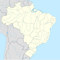
Barbacena − miasto we wschodniej Brazylii, w stanie Minas Gerais, w północnej części pasma górskiego Serra da Mantiqueira (Wyżyna Brazylijska). Około 115 tys. mieszkańców.
Współpraca
Linki zewnętrzne
Przypisy
Media użyte na tej stronie
The flag of Navassa Island is simply the United States flag. It does not have a "local" flag or "unofficial" flag; it is an uninhabited island. The version with a profile view was based on Flags of the World and as a fictional design has no status warranting a place on any Wiki. It was made up by a random person with no connection to the island, it has never flown on the island, and it has never received any sort of recognition or validation by any authority. The person quoted on that page has no authority to bestow a flag, "unofficial" or otherwise, on the island.
Autor:
- MinasGerais_MesoMicroMunicip.svg: Raphael Lorenzeto de Abreu
- derivative work: Milenioscuro (talk)
Location map of Minas Gerais state.
Equirectangular projection, N/S stretching 106 %. Geographic limits of the map:
- N: 13.93° S
- S: 23.67° S
- W: 51.80° W
- E: 39.80° W


