Barra do Ribeiro
(c) Paulo RS Menezes, CC BY-SA 3.0 br | |||||
| |||||
| Państwo | |||||
|---|---|---|---|---|---|
| Stan | |||||
| Data założenia | 1959 | ||||
| Powierzchnia | 730,816[1] km² | ||||
| Wysokość | 5 m n.p.m. | ||||
| Populacja (2010) • liczba ludności • gęstość |
| ||||
| Nr kierunkowy | 51 | ||||
| Strona internetowa | |||||
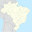
Barra do Ribeiro – miasto i gmina w Brazylii, w stanie Rio Grande do Sul. Znajduje się w mezoregionie Metropolitana de Porto Alegre i mikroregionie Camaquã.
Przypisy
Media użyte na tej stronie
Autor:
- RioGrandedoSul_MesoMicroMunicip.svg: Raphael Lorenzeto de Abreu
- derivative work: Milenioscuro (talk)
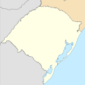
Location map of Rio Grande do Sul state.
Equirectangular projection, N/S stretching 115 %. Geographic limits of the map:
- N: 26.59° S
- S: 33.87° S
- W: 57.79° W
- E: 49.35° W
Flag of the State of Rio Grande do Sul, Brazil
Coat of arm of the city of Barra do Ribeiro, Rio Grande do Sul, Brazil.
Flag of Barra do Ribeiro - RS - Brazil.


