Basma
| Państwo | |
|---|---|
| Dystrykt | |
| Powierzchnia | 1,8 km² |
| Populacja (2006) • liczba ludności • gęstość |
|
| Nr kierunkowy | +972 4 |
| Portal | |
Basma (hebr. בסמ"ה, arab. بسم) – samorząd lokalny położony w dystrykcie Hajfa, w Izraelu.
Miasteczko leży na południe od miasta Umm al-Fahm, w paśmie górskim Karmel.
Demografia
Zgodnie z danymi Izraelskiego Centrum Danych Statystycznych w 2006 roku w osadzie żyło 7,8 tys. mieszkańców, wszyscy Arabowie[1].
Populacja osady pod względem wieku (dane z 2006):
| Wiek (w latach) | Procent populacji w % |
|---|---|
| 0-4 | 14,9% |
| 5-9 | 26,6% |
| 10-14 | 9,9% |
| 15-19 | 8,3% |
| 20-29 | 13,8% |
| 30-44 | 16,0% |
| 45-59 | 7,1% |
| ponad 60 | 3,4% |
Źródło danych: Central Bureau of Statistics.
Przypisy
- ↑ Israel Central Bureau of Statistics (ang.). [dostęp 2008-04-25].
Linki zewnętrzne
- Zdjęcie satelitarne Basma Google Maps
- Mapa Basma
Media użyte na tej stronie
Autor: NordNordWest, Licencja: CC BY-SA 3.0
Flag of Israel. Shows a Magen David (“Shield of David”) between two stripes. The Shield of David is a traditional Jewish symbol. The stripes symbolize a Jewish prayer shawl (tallit).
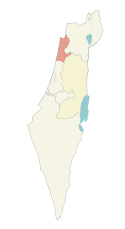
Haifa District of Israel
Autor: RickP 20:15, 28 May 2006 (UTC), Licencja: CC BY 2.5
Panoramic photo (composite) of Um al-Qutuf and Bartaa, Israel, with Katzir visible in the far left; May 27, 2006; 18:40 AM; view from west


