Basr al-Harir
| ||
 | ||
| Państwo | ||
| Muhafaza | Dara | |
| Populacja (2004) • liczba ludności | 13 315 [1] | |
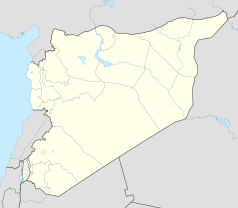
Położenie na mapie Syrii (c) Karte: NordNordWest, Lizenz: Creative Commons by-sa-3.0 de | ||
Basr al-Harir (arab. بصر الحرير) – miasto w Syrii, w muhafazie Dara. W 2004 roku liczyło 13 315 mieszkańców.
Przypisy
- ↑ Syrian Arab Republic - Population Statiscs - syr_pop_2004_sycensus_0.xls - Humanitarian Data Exchange, data.humdata.org [dostęp 2017-11-17] (ang.).
Media użyte na tej stronie
Syria location map3.svg
(c) Karte: NordNordWest, Lizenz: Creative Commons by-sa-3.0 de
Location map of Syria. De facto situation.
(c) Karte: NordNordWest, Lizenz: Creative Commons by-sa-3.0 de
Location map of Syria. De facto situation.
Flag of Syria.svg
Łatwo można dodać ramkę naokoło tej grafiki
Łatwo można dodać ramkę naokoło tej grafiki
Ifpo 21280 Syrie, Gouvernorat de Deraa, région du Hauran, Bousra al-Harir, vue aérienne oblique (cropped).jpg
Autor: Army of the Levant , Licencja: Licence Ouverte
Syrie, Gouvernorat de Deraa, région du Hauran, Bousra al-Harir, vue aérienne oblique
Autor: Army of the Levant , Licencja: Licence Ouverte
Syrie, Gouvernorat de Deraa, région du Hauran, Bousra al-Harir, vue aérienne oblique


