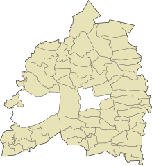
Bassetlaw
| ||
| dystrykt niemetropolitalny | ||
 Worksop | ||
| Państwo | ||
|---|---|---|
| Kraj | ||
| Region | East Midlands | |
| Hrabstwo | Nottinghamshire | |
| Siedziba | Worksop | |
| Powierzchnia | 637,9 km² | |
| Populacja (2011) • liczba ludności | 112 863 | |
| • gęstość | 180 os./km² | |
| Szczegółowy podział administracyjny | ||
 | ||
| Liczba civil parishes | 68 parishes + 2 miasta | |
| Położenie na mapie Nottinghamshire (c) Nilfanion, created using Ordnance Survey data, CC BY-SA 3.0 | ||
| Strona internetowa | ||
| Portal | ||
Bassetlaw – dystrykt w hrabstwie Nottinghamshire w Anglii. W 2011 roku dystrykt liczył 112 863 mieszkańców[1].
Miasta
Inne miejscowości
Askham, Babworth, Barnby Moor, Beckingham, Bevercotes, Bilby, Bircotes, Blyth, Bole, Bothamsall, Carburton, Carlton in Lindrick, Church Laneham, Coates, Darlton, Dunham, East Drayton, East Markham, Eaton, Elkesley, Everton, Gamston, Gateford, Gringley-on-the-Hill, Harworth, Haughton, Hayton, Holbeck Woodhouse, Holbeck, Langold, Littleborough, Lound, Manton, Markham Moor, Mattersey, Milton, Misson, Misterton, Nether Langwith, Normanton on Trent, Ordsall, Ragnall, Rampton, Ranby, Ranskill, Rhodesia, Scrooby, Shireoaks, South Leverton, Sturton le Steeple, Sutton cum Lound, Tiln, Torworth, Treswell, Tuxford, Walkeringham, Wallingwells, West Stockwith.
Przypisy
- ↑ Area: Bassetlaw (Local Authority) (ang.). Neighbourhood Statistics (ONS). [dostęp 2016-04-25]. [zarchiwizowane z tego adresu (2016-10-03)].
Media użyte na tej stronie
Flag of England. Saint George's cross (a red cross on a white background), used as the Flag of England, the Italian city of Genoa and various other places.
Map of Bassetlaw parishes
(c) Nilfanion, created using Ordnance Survey data, CC BY-SA 3.0
Bassetlaw shown in Nottinghamshire.
Autor: Leeds543, Licencja: CC BY-SA 3.0
Worksop Priory is a Church of England parish church and former priory located in the Nottinghamshire town of Worksop. It was built in 1103.


