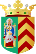
Bathmen
 | |||||
| Państwo | |||||
|---|---|---|---|---|---|
| Prowincja | |||||
| Powierzchnia | 1,4 km² | ||||
| Populacja (2018) • liczba ludności • gęstość |
| ||||
| Kod pocztowy | 7437 | ||||
| Strefa czasowa | UTC+1 | ||||
| Strona internetowa | |||||
Bathmen – wieś w prowincji Overijssel, w Holandii[1]. Według danych na rok 2018 wieś zamieszkiwało 4255 osób, a gęstość zaludnienia wyniosła 2994 os./km2.
Demografia
Populacja:
| Rok | 2001 | 2008 | 2011 | 2018 |
|---|---|---|---|---|
| Ludność | 3855 | 3965 | 4140 | 4255 |
Ludność według grup wiekowych na rok 2011:
| Wiek | 0–14 lat | 15–64 lat | 65+ lat |
|---|---|---|---|
| Liczba osób w danej grupie wiekowej | 795 | 2525 | 820 |
| Liczba osób w danej grupie wiekowej w % | 19,2% | 61% | 19,8% |
Struktura płci na rok 2011:
| Płeć | Mężczyźni | Kobiety |
|---|---|---|
| Liczba osób w danej płci | 2040 | 2100 |
| Liczba osób w danej płci w % | 49,3% | 50,7% |
Klimat
Klimat jest umiarkowany[2]. Średnia temperatura wynosi 8 °C[3]. Najcieplejszym miesiącem jest lipiec (18 °C)[3], a najzimniejszym miesiącem jest luty (0 °C)[3].
Przypisy
- ↑ GeoNames.org, www.geonames.org [dostęp 2021-07-29].
- ↑ Zaktualizowana mapa świata [dostęp 2021-07-29].
- ↑ a b c Browse datasets | NASA Earth Observations (NEO), Browse datasets | NASA Earth Observations (NEO), 29 lipca 2021 [dostęp 2021-07-29] (ang.).
Linki zewnętrzne
Media użyte na tej stronie
Coat of arms of the former Dutch municipality of Bathmen 1989 version
Autor: Michielverbeek, Licencja: CC BY-SA 3.0
between Bathmen and Harfsen, stream: de Dorther Beek


