Batowice (Kraków)
| część miasta Krakowa | |
| Państwo | |
|---|---|
| Województwo | |
| Miasto | |
| Dzielnica | |
| W granicach Krakowa | |
Położenie na mapie Polski (c) Karte: NordNordWest, Lizenz: Creative Commons by-sa-3.0 de | |
| Portal | |
Batowice – obszar Krakowa wchodzący w skład Dzielnicy XV Mistrzejowice. Stanowi przyłączony do miasta 1 stycznia 1973 r. fragment (50 ha) wsi Batowice[1].
Zobacz też
Przypisy
Media użyte na tej stronie
Kraków location map.svg
Autor: SANtosito, Licencja: CC BY-SA 4.0
Mapa lokacyjna miasta Kraków. Punkty graniczne mapy:
Autor: SANtosito, Licencja: CC BY-SA 4.0
Mapa lokacyjna miasta Kraków. Punkty graniczne mapy:
- N: 50.15 N
- S: 49.95 N
- W: 19.76 E
- E: 20.26 E
Poland adm location map.svg
(c) Karte: NordNordWest, Lizenz: Creative Commons by-sa-3.0 de
Location map of Poland
(c) Karte: NordNordWest, Lizenz: Creative Commons by-sa-3.0 de
Location map of Poland
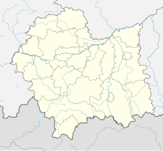
Lesser Poland Voivodeship location map.svg
Autor: SANtosito, Licencja: CC BY-SA 4.0
Location map of Lesser Poland Voivodeship, Poland. Geographic limits of the map:
Autor: SANtosito, Licencja: CC BY-SA 4.0
Location map of Lesser Poland Voivodeship, Poland. Geographic limits of the map:
- N: 50.59 N
- S: 49.07 N
- W: 18.92 E
- E: 21.55 E


