Battenberg (Eder)
(c) User: Celsius z wikipodróże shared, CC BY-SA 3.0 | |||
| |||
| Państwo | |||
|---|---|---|---|
| Kraj związkowy | Hesja | ||
| Rejencja | Kassel | ||
| Powiat | Waldeck-Frankenberg | ||
| Powierzchnia | 64,73 km² | ||
| Wysokość | 340 m n.p.m. | ||
| Populacja (2015-12-31) • liczba ludności • gęstość | 5414[1] 82,99 os./km² | ||
| Nr kierunkowy | 06452 | ||
| Kod pocztowy | 35088 | ||
| Tablice rejestracyjne | KB, FKB, WA | ||
 | |||
| Strona internetowa | |||
| Portal | |||
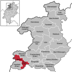
Battenberg (Eder) – miasto w Niemczech, w kraju związkowym Hesja, w rejencji Kassel, w powiecie Waldeck-Frankenberg, nad rzeką Eder.
Przypisy
- ↑ Die Bevölkerung in Hessen am 31.12.2015 (niem.). statistik.hessen.de. [dostęp 2017-02-17].
Zobacz też
Kontrola autorytatywna (miasteczko):
Media użyte na tej stronie
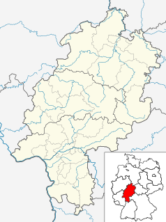
Hesse location map G.svg
Autor: Hanhil based on work by TUBS, Licencja: CC BY-SA 3.0
Location map Hesse, showing position of Bavaria within Germany. Geographic limits of the map:
Autor: Hanhil based on work by TUBS, Licencja: CC BY-SA 3.0
Location map Hesse, showing position of Bavaria within Germany. Geographic limits of the map:
Germany location map.svg
Autor: NordNordWest, Licencja: CC BY-SA 3.0
Location map of Germany (Wp article: en:Germany)
Autor: NordNordWest, Licencja: CC BY-SA 3.0
Location map of Germany (Wp article: en:Germany)
Wappen Battenberg Eder.svg
Wappen von Battenberg (Eder). Das Wappen ist vor 1291 entstanden und damit möglicherweise das älteste Hessische Stadtwappen.
Wappen von Battenberg (Eder). Das Wappen ist vor 1291 entstanden und damit möglicherweise das älteste Hessische Stadtwappen.
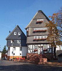
Battenberg eder rathaus ds wv 09 2005.jpg
(c) User: Celsius z wikipodróże shared, CC BY-SA 3.0
Germany / Hesse: Battenberg (Eder): old town hall
(c) User: Celsius z wikipodróże shared, CC BY-SA 3.0
Germany / Hesse: Battenberg (Eder): old town hall


