Bauru
 | |||||
| Państwo | |||||
|---|---|---|---|---|---|
| Stan | |||||
| Burmistrz | Tuga Angerami | ||||
| Powierzchnia | 667,684 km² | ||||
| Wysokość | 526 m n.p.m. | ||||
| Populacja (2021) • liczba ludności • gęstość |
| ||||
| Nr kierunkowy | 014 | ||||
| Strona internetowa | |||||
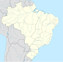
Bauru – miasto w południowo-wschodniej Brazylii, w środkowej części stanu São Paulo, liczące 381,7 tys. mieszkańców (2021).
W mieście rozwinął się przemysł spożywczy, włókienniczy oraz drzewny[2].
Przypisy
- ↑ Estimativas da populaçao para 1o de julho de 2009
- ↑ Bauru, [w:] Encyklopedia PWN [online] [dostęp 2021-10-18].
Media użyte na tej stronie
Autor: Raphael Lorenzeto de Abreu, Licencja: CC BY 2.5
Location map of São Paulo state.
Equirectangular projection, N/S stretching 108 %. Geographic limits of the map:
- N: 19.67° S
- S: 25.45° S
- W: 53.20° W
- E: 44.01° W
Autor: Marco Senche / Marco Antônio, Licencja: CC BY-SA 2.0
Vista panorâmica da região da avenida Nações Unidas, em Bauru, São Paulo, Brasil.
This work is in the public domain in Brazil for one of the following reasons:
- It is a work published or commissioned by a Brazilian government (federal, state, or municipal) prior to 1983. (Law 3071/1916, art. 662; Law 5988/1973, art. 46; Law 9610/1998, art. 115)
- It is the text of a treaty, convention, law, decree, regulation, judicial decision, or other official enactment. (Law 9610/1998, art. 8)
- It is a work whose authors' rights belong to the Brazilian government (federal, state, or municipal), for which the economic rights shall be protected for a period of 70 years from the first of January of the year following that of their disclosure or that of the author's demise, whichever is later. ([1])


