Bawły
 | |||||
| Państwo | |||||
|---|---|---|---|---|---|
| Republika | |||||
| Data założenia | 1658 | ||||
| Prawa miejskie | 1997 | ||||
| Wysokość | 210 m n.p.m. | ||||
| Populacja (2010) • liczba ludności | 23 213 | ||||
| Nr kierunkowy | +7 85569 | ||||
| Kod pocztowy | 423930 | ||||
| Tablice rejestracyjne | 16, 116 | ||||
| Strona internetowa | |||||
| Portal | |||||
Bawły (tat. Баулы, Bawlı; ros. Бавлы) – miasto w europejskiej części Rosji, w Tatarstanie, położone w południowym Uralu, nad rzeką Bawłą 369 km od Kazania. Nazwa bałły epga znaczy miodowa rzeczka. Główna religia - islam.
Linki zewnętrzne
- Oficjalna strona Tatarstanu (po rosyjsku)
- Oficjalna strona Tatarstanu (po angielsku)
- Oficjalna strona Tatarstanu (po tatarsku, w cyrylicy)
Media użyte na tej stronie
Autor: Uwe Dedering, Licencja: CC BY-SA 3.0
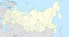
Location map of Russia.
EquiDistantConicProjection : Central parallel :
* N: 54.0° N
Central meridian :
* E: 100.0° E
Standard parallels:
* 1: 49.0° N
* 2: 59.0° N
Made with Natural Earth. Free vector and raster map data @ naturalearthdata.com.
Because the southern Kuril islands are claimed by Russia and Japan, they are shown as disputed. For more information about this see: en:Kuril Islands dispute. These islands are since 1945 under the jurisdiction of the Russian Federation.
Bavly (Tatarstan), coat of arms
Bavly (Tatarstan), flag
Position map of the Republic of Tatarstan ~
Equiangular projection, stretching - 175%. Coordinates of the edges:
- North - 56.8° C
- South - 53.9° C
- East - 54.5° B
- West - 47.0° V
The Coat of Arms of Tatarstan.


