Beerse
 Kościół w Beerse | |||||
| |||||
| Państwo | |||||
|---|---|---|---|---|---|
| Region | |||||
| Prowincja | |||||
| Zarządzający | Bart Craane↗ | ||||
| Powierzchnia | 37,48 km² | ||||
| Populacja (2016) • liczba ludności • gęstość | |||||
| Nr kierunkowy | 014 | ||||
| Kod pocztowy | 2340 | ||||
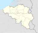
Położenie na mapie Belgii (c) Karte: NordNordWest, Lizenz: Creative Commons by-sa-3.0 de | |||||
| Strona internetowa | |||||
Beerse – gmina położona w prowincji Antwerpia, w Belgii.
Populacja
- Źródła: NIS, od 1806 do 1981= według spisu; od 1990 liczba ludności w dniu 1 stycznia
Według szacunków w dniu 1 stycznia 2016 całkowita populacja Beerse liczyła 17 829 osób. Łączna powierzchnia gminy wynosi 37,48 km², co daje gęstość zaludnienia 480 mieszkańców na km².
Przypisy
- ↑ a b Population de droit par commune, par sexe. statbel.fgov.be. [dostęp 2017-02-21]. (fr.).
Media użyte na tej stronie
Autor: Tom Lemmens, Licencja: CC0
Flag of Flanders (Belgium), the region and community.
Wapenschild van Beerse
Autor: John Scholte, Licencja: CC BY-SA 4.0
This is a photo of onroerend erfgoed number
Municipal flag of Beerse, Belgium.
The municipal flag of Beerse is blue with a crenelled yellow horizontal stripe and three yellow eight-pointed stars, two above the stripe and one below it.(c) Karte: NordNordWest, Lizenz: Creative Commons by-sa-3.0 de
Location map of Belgium


