Bellevue de l’Inini
| Ten artykuł od 2022-07 wymaga zweryfikowania podanych informacji. |
© Sémhur / Wikimedia Commons, CC BY-SA 4.0 | |
| Państwo | |
|---|---|
| Departament zamorski | |
| Położenie | |
| Pasmo | montagnes Inini-Camopi↗ |
| Wysokość | 851 m n.p.m. |
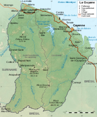
Bellevue de l’Inini – szczyt w Gujanie Francuskiej, francuskim terytorium zależnym. Jest to najwyższy szczyt Gujany Francuskiej.
Linki zewnętrzne
Media użyte na tej stronie
Black up-pointing triangle ▲, U+25B2 from Unicode-Block Geometric Shapes (25A0–25FF)
Autor: Eric Gaba (Sting - fr:Sting), Licencja: CC BY-SA 3.0
Blank physical map of the region and department of the French Guiana, France, for geo-location purpose, with arrondissements boundaries.


