Biełaja Kalitwa
 Rzeka Kalitwa | |||||
| |||||
| Państwo | |||||
|---|---|---|---|---|---|
| Obwód | |||||
| Populacja (2014) • liczba ludności |
| ||||
| Nr kierunkowy | +7 86383 | ||||
| Kod pocztowy | 347040–347049 | ||||
| Tablice rejestracyjne | 61, 161 | ||||
| Portal | |||||
Biełaja Kalitwa (ros. Белая Калитва) — miasto w Rosji, administracyjne centrum rejonu w obwodzie rostowskim.
Osada została założona w 1703 roku w granicach Carstwa Rosyjskiego. W 1958 osada otrzymała prawa miejskie.
Media użyte na tej stronie
Autor: Uwe Dedering, Licencja: CC BY-SA 3.0
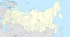
Location map of Russia.
EquiDistantConicProjection : Central parallel :
* N: 54.0° N
Central meridian :
* E: 100.0° E
Standard parallels:
* 1: 49.0° N
* 2: 59.0° N
Made with Natural Earth. Free vector and raster map data @ naturalearthdata.com.
Because the southern Kuril islands are claimed by Russia and Japan, they are shown as disputed. For more information about this see: en:Kuril Islands dispute. These islands are since 1945 under the jurisdiction of the Russian Federation.
Belaya Kalitva (Rostov oblast), coat of arms
Flag of Belaya Kalitva urban settlement, Rostov Oblast, Russia
Позиционная карта Ростовской области
Равноугольная проекция, растяжение — 150 %. Координаты краёв:
- север — 50.5° С
- юг — 45.5° С
- восток — 44.5° В
- запад — 38.0° В
Coat of arms of Rostov Oblast, Russia.
Autor: Rumlin, Licencja: CC BY-SA 3.0
The Kalitva river in the town of Belaya Kalitva. View of the confluence of this river into the Seversky Donets.


