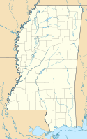
Biloxi
| City | |
 | |
| Przydomek: The Playground of the South, Buck City, The Promiseland | |
| Państwo | |
|---|---|
| Stan | |
| Hrabstwo | |
| Data założenia | 1719[1] |
| Prawa miejskie | 1896[1] |
| Kod statystyczny | |
| Zarządzający | A.J. Holloway |
| Powierzchnia | 98,99[2] km² |
| Wysokość | 6 m n.p.m. |
| Populacja (2013) • liczba ludności • gęstość | |
| Nr kierunkowy | 228 |
| Kod pocztowy | 39530-39535, 39540 |
| Strefa czasowa | |
| Strona internetowa | |
| Portal | |
Biloxi – miasto (city) w Stanach Zjednoczonych, w stanie Missisipi, położone nad Zatoką Meksykańską, na półwyspie oddzielonym od lądu zatoką Back Bay of Biloxi. Tworzy zespół miejski wraz z sąsiednim Gulfport, z którym współdzieli także funkcję siedziby władz hrabstwa Harrison[3]. Liczba mieszkańców Biloxi wynosi 44 820 (2013)[2], a aglomeracji 248 820 (2010)[3].
Miasto założone zostało przez Francuzów na początku XVIII wieku (Fort Maurepas, obecnie w granicach miasta Ocean Springs, znany też jako Old Biloxi („stare Biloxi”) powstał już w 1699 roku). W latach 1719–1722 miasto było stolicą francuskiej Luizjany. W późniejszych latach miasto znalazło się w rękach brytyjskich, a następnie hiszpańskich. W 1810 roku miasto należało do krótkotrwałej Republiki Florydy Zachodniej, po czym wcielone zostało do Stanów Zjednoczonych[3].
Ze względu na swoje położenie miasto wielokrotnie nawiedzane było przez huragany, w tym szczególnie dotkliwe Camille (1969) i Katrina (2005)[3].
W mieście rozwinął się przemysł stoczniowy oraz spożywczy[1].
W Biloxi znajduje się baza wojskowa Keesler Air Force Base[3].
Przypisy
Media użyte na tej stronie
Autor: Uwe Dedering, Licencja: CC BY-SA 3.0
Location map of the USA (without Hawaii and Alaska).
EquiDistantConicProjection:
Central parallel:
* N: 37.0° N
Central meridian:
* E: 96.0° W
Standard parallels:
* 1: 32.0° N
* 2: 42.0° N
Made with Natural Earth. Free vector and raster map data @ naturalearthdata.com.
Formulas for x and y:
x = 50.0 + 124.03149777329222 * ((1.9694462586094064-({{{2}}}* pi / 180))
      * sin(0.6010514667026994 * ({{{3}}} + 96) * pi / 180))
y = 50.0 + 1.6155950752393982 * 124.03149777329222 * 0.02613325650382181
      - 1.6155950752393982  * 124.03149777329222 *
     (1.3236744353715044  - (1.9694462586094064-({{{2}}}* pi / 180))
      * cos(0.6010514667026994 * ({{{3}}} + 96) * pi / 180))
The flag of Navassa Island is simply the United States flag. It does not have a "local" flag or "unofficial" flag; it is an uninhabited island. The version with a profile view was based on Flags of the World and as a fictional design has no status warranting a place on any Wiki. It was made up by a random person with no connection to the island, it has never flown on the island, and it has never received any sort of recognition or validation by any authority. The person quoted on that page has no authority to bestow a flag, "unofficial" or otherwise, on the island.
MGM Resorts International's Beau Rivage Resort & Casino in Biloxi, Mississippi. This photo was taken just after Hurricane Katrina in 2005, and does not depict the current beauty and growth as of 2012.
Autor: Rocky Vaughn, Sue Anna Joe, Dominique Pugh, Clay Moss, Kara Giles, and the Mississippi Department of Archives and History, Licencja: Copyrighted free use
The state flag of Mississippi, created in 2020 and adopted in 2021. Known as the "New Magnolia", it was the final design selected by the Commission to Redesign the Mississippi State Flag in 2020.
Autor: Alexrk2, Licencja: CC BY 3.0
Ta mapa została stworzona za pomocą GeoTools.


