Bitwa pod Plocznikiem
 | |||
| Czas | |||
|---|---|---|---|
| Miejsce | Pločnik | ||
| Terytorium | |||
| Wynik | Zwycięstwo Serbów | ||
| Strony konfliktu | |||
| |||
| Dowódcy | |||
| |||
| Siły | |||
| |||
| Straty | |||
| |||
| 43°12′06,8400″N 21°21′20,1600″E/43,201900 21,355600 | |||
Bitwa pod Plocznikiem – starcie zbrojne, które miało miejsce w roku 1386 w trakcie najazdów osmańskich na Bałkany.
Bitwa zakończyła się zwycięstwem wojsk serbskich i bośniackich pod wodzą księcia Łazarza nad siłami osmańskimi.
Bibliografia
- Edward Potkowski: Warna 1444, wyd. Bellona, Warszawa 2004.
Media użyte na tej stronie
zwei stilisierte gekreuzte Schwerter als Zeichen zur Nutzung in Karten, in der Genealogie, etc.; Unicode-Zeichen U+2694
Turkey has no official coat of arms, this star and crescent is being used on passports, ID cards, driving licences, embassy signs, seal of the presidential office, seal of the TBMM and the seal of the Ministry of Foreign Affairs.
Element from the coat of arms of Serbia that interpretates exactly the text in the constitution of Republic of Serbia. ATTENTION! THIS IS NOT AN OFFICIAL COAT OF ARMS!
Autor: Geologicharka, Licencja: CC BY-SA 3.0
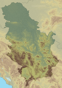
Relief map of Serbia.
World Mercator projection
- N: 46.3° N
- S: 41.7° N
- W: 18.7° E
- E: 23.2° E
States in the Central Balkans that emerged after dissolution of Serbian Empire in the 14th century (1373-1395):


