Blaye
| gmina | |||||
 | |||||
| Państwo | |||||
|---|---|---|---|---|---|
| Region | |||||
| Departament | |||||
| Okręg | Blaye Blaye | ||||
| Kanton | Blaye | ||||
| Kod INSEE | 33058 | ||||
| Powierzchnia | 6,42 km² | ||||
| Populacja (1990) • liczba ludności |
| ||||
| • gęstość | 668 os./km² | ||||
| Portal | |||||
Blaye – miejscowość i gmina we Francji, w regionie Nowa Akwitania, w departamencie Żyronda.
Według danych na rok 1990 gminę zamieszkiwało 4286 osób, a gęstość zaludnienia wynosiła 668 osób/km².
Cytadela
Twierdza zbudowana w latach 1685-1689[1] na podstawie zasad opracowanych przez Sebastiana Vaubana jako część tzw. Fortyfikacji Vaubana, których celem była ochrona granic Francji.
Przypisy
- ↑ Henri Stierlin: Zabytki architektury obronnej. Warszawa: Wydawnictwo G+J RBA Sp. z o.o. & Co. Spółka Komandytowa. ISBN 83-60006-16-4.
Bibliografia
- Francuski urząd statystyczny. (fr.).
Media użyte na tej stronie
Autor: Flappiefh, Licencja: CC BY-SA 4.0
Carte administrative vierge du département de Gironde, France, destinée à la géolocalisation.
Autor: Superbenjamin, Licencja: CC BY-SA 4.0
Blank administrative map of France for geo-location purpose, with regions and departements distinguished. Approximate scale : 1:3,000,000
Autor: Flappiefh, Licencja: CC BY-SA 4.0
Carte administrative vierge de la région Aquitaine-Limousin-Poitou-Charentes, France, destinée à la géolocalisation.
Autor: Zorlot, Licencja: CC BY-SA 4.0
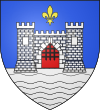
Blason Blaye (Gironde) :D'azur à la porte de gueules coulissée de sable, fortifiée de deux tours, le tout d'argent maçonné aussi de sable, surmonté d'une fleur de lys d'or et posé sur une rivière ondée aussi d'argent mouvant de la pointe.
Flag of Blaye in the department of Gironde.
Autor: Cobber17, Licencja: CC BY-SA 3.0
Une autre vue sur Blaye, Aquitaine, Gironde, France


