Bołgar
(c) Kremlin.ru, CC BY 4.0 | |||||
| |||||
| Państwo | |||||
|---|---|---|---|---|---|
| Republika | |||||
| Data założenia | X wiek | ||||
| Populacja • liczba ludności |
| ||||
| Nr kierunkowy | 84347 | ||||
| Kod pocztowy | 422840 | ||||
| Strona internetowa | |||||
| Portal | |||||
Bołgar, dawniej Spask – miasto w Tatarstanie, siedziba rejonu spaskiego.
Współczesne miasto powstało ze wsi Spassk (Czertykowo) położonej na brzegu rzeki Bezdna. W 1926 roku zmieniono jej nazwę na Spassk-Tatarski (Спасск-Татарский), natomiast w 1935 roku zmieniono jej nazwę na Kujbyszew na cześć Waleriana Kujbyszewa. Obecną nazwę Bołgar nadano w 1991 roku. Miasto jest centrum administracyjnym od 1930 roku.
Patrz także: Bułgar Wielki
Linki zewnętrzne
- Spask, [w:] Słownik geograficzny Królestwa Polskiego, t. XI: Sochaczew – Szlubowska Wola, Warszawa 1890, s. 104.
Media użyte na tej stronie
Position map of the Republic of Tatarstan ~
Equiangular projection, stretching - 175%. Coordinates of the edges:
- North - 56.8° C
- South - 53.9° C
- East - 54.5° B
- West - 47.0° V
Autor: Uwe Dedering, Licencja: CC BY-SA 3.0
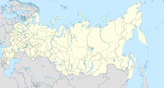
Location map of Russia.
EquiDistantConicProjection : Central parallel :
* N: 54.0° N
Central meridian :
* E: 100.0° E
Standard parallels:
* 1: 49.0° N
* 2: 59.0° N
Made with Natural Earth. Free vector and raster map data @ naturalearthdata.com.
Because the southern Kuril islands are claimed by Russia and Japan, they are shown as disputed. For more information about this see: en:Kuril Islands dispute. These islands are since 1945 under the jurisdiction of the Russian Federation.
The Coat of Arms of Tatarstan.
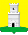
Герб города Болгар, принят в 2005 году.
(c) Kremlin.ru, CC BY 4.0
Mosque in the museum-reserve of history and architecture in Bolgar, Republic of Tatarstan


