Bogda Feng
 | |
| Państwo | |
|---|---|
| Położenie | Sinciang |
| Pasmo | Bogda Shan, Tienszan |
| Wysokość | 5445 m n.p.m. |
| Wybitność | 4122 m |
| Pierwsze wejście | 1981 wyprawa japońska |
Bogda Feng (chiń. upr. 博格达峰; chiń. trad. 博格達峰; pinyin Bógédá Fẽng) – najwyższy szczyt w pasmie Bogda Shan, we wschodniej części gór Tienszan, na terytorium Chin. Stoki tego szczytu są nachylone od 70° do 80°, co miało wpływ na to, że szczyt został zdobyty dopiero w 1981 roku.
Linki zewnętrzne
Media użyte na tej stronie
Black up-pointing triangle ▲, U+25B2 from Unicode-Block Geometric Shapes (25A0–25FF)
Autor: lwtt93 from Shanghai, China, Licencja: CC BY 2.0
博格达峰,海拔5445 米,是天山东部博格达山的最高峰。Mt.Tianshan,a tremendous mountain range in mid Aisa,across midland of Xinjing China,extending its west end into Kazakstan.It is in vicinity of 2500 kilometers in length,250 to 300 kilometers in breadth and 5000 meters in average height. Now,the peak we see--Bogda is 5445 meters above sea level.The pot I took this picture is about 1000 meters above sea level.
Autor: Uwe Dedering, Licencja: CC BY-SA 3.0
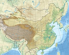
Location map of China.
EquiDistantConicProjection : Central parallel :
* N: 36.0° N
Central meridian :
* E: 104.0° E
Standard parallels :
* 1: 30.0° N
* 2: 42.0° N
Latitudes on the central meridian :
* top: 57.0° N
* center: 37.29° N
* bottom: 17.96° N
Made with Natural Earth. Free vector and raster map data @ naturalearthdata.com.


