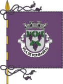
Bombarral
| gmina | |||||
 | |||||
| Państwo | |||||
|---|---|---|---|---|---|
| Dystrykt | |||||
| Kraina historyczna | |||||
| Region (NUTS 2) | |||||
| Podregion (NUTS 3) | Oeste | ||||
| Powierzchnia | 90,44 km² | ||||
| Populacja (2011) • liczba ludności |
| ||||
| • gęstość | 145,9 os./km² | ||||
| Szczegółowy podział administracyjny | |||||
| Liczba sołectw | 5 | ||||
Położenie na mapie Portugalii | |||||
| 39°16′N 9°09′W/39,266667 -9,150000 | |||||
Bombarral – miejscowość w Portugalii, leżąca w dystrykcie Leiria, w regionie Centrum w podregionie Oeste. Miejscowość jest siedzibą gminy o tej samej nazwie.
Demografia
| Liczba ludności gminy Bombarral (1920–2011) | |||||||
|---|---|---|---|---|---|---|---|
| 1920 | 1930 | 1960 | 1981 | 1991 | 2001 | 2004 | 2011 |
| 11 206 | 12 669 | 15 209 | 13 758 | 12 727 | 13 324 | 13 712 | 13 193[1] |
Sołectwa
Sołectwa gminy Bombarral (ludność wg stanu na 2011 r.):[1]
- Bombarral - 5664 osoby
- Carvalhal - 2634 osoby
- Pó - 930 osób
- Roliça - 2808 osób
- Vale Covo - 1157 osób
Przypisy
- ↑ a b c Statistics Portugal, www.ine.pt [dostęp 2018-02-11] (ang.).
Media użyte na tej stronie
Flag of Portugal, created by Columbano Bordalo Pinheiro (1857-1929), officially adopted by Portuguese government in June 30th 1911 (in use since about November 1910). Color shades matching the RGB values officially reccomended here. (PMS values should be used for direct ink or textile; CMYK for 4-color offset printing on paper; this is an image for screen display, RGB should be used.)
Autor: , Licencja: CC BY 2.5
Imagem criada por Rei-artur, em Janeiro de 2005, a partir do mapa Image:Mapa de Portugal.svg.
Autor: Vitor Oliveira from Torres Vedras, PORTUGAL, Licencja: CC BY 2.0
Bombarral (Portugal)


