Bongaigaon (dystrykt)
| Dystrykt | |
 | |
| Państwo | |
|---|---|
| Stan | |
| Siedziba | |
| Powierzchnia | 2510 km² |
| Populacja (2001) • liczba ludności |
|
| • gęstość | 361 os./km² |
Położenie na mapie Indii | |
| 26°28′00″N 90°34′00″E/26,466700 90,566700 | |
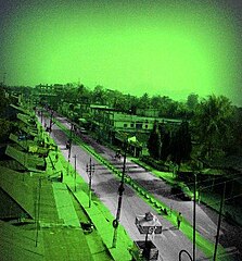
Bongaigaon (hindi बोंगाइगांव जिला) – jest jednym z 27 dystryktów administracyjnych w stanie Asam w Indiach[1], położony w północno-wschodniej części stanu. Stolicą dystryktu jest miasto Bongaigaon. Dystrykt graniczy z dystryktem Barpeta od wschodu. Od południa granicę wyznacza rzeka Brahmaputra, a od północy i zachodu rzeka Kokrajahr. Rejon ma obszar 2510 km²[2], a populacja wyniosła 906 315 osób, w 2001 roku.
Demografia
- Liczba ludności 906,315 (według spisu w 2001 roku).
- Główne religie to : hinduizm 535 464, islam 348 573, chrześcijaństwo 18,728.
Dystrykt Bongaigaon został stworzony w 1989 z fragmentów dystryktów Goalpara oraz Kokrajhar. Dystrykt dzieli się na trzy jednostki zależne (subdivisions); Bongaigaon, Bijni oraz North Salmara. W roku 2004 część dystryktu Bongaigaon (w większości tereny z rejonu Bijni) zostały odłączone, aby utworzyć nowy dystrykt – Chirang, ze stolicą w Kajalgaon.
Zobacz też
Linki zewnętrzne
Przypisy
Media użyte na tej stronie
(c) Uwe Dedering z niemieckiej Wikipedii, CC BY-SA 3.0
Location map of India.
Equirectangular projection. Strechted by 106.0%. Geographic limits of the map:
- N: 37.5° N
- S: 5.0° N
- W: 67.0° E
- E: 99.0° E
The Flag of India. The colours are saffron, white and green. The navy blue wheel in the center of the flag has a diameter approximately the width of the white band and is called Ashoka's Dharma Chakra, with 24 spokes (after Ashoka, the Great). Each spoke depicts one hour of the day, portraying the prevalence of righteousness all 24 hours of it.
Autor: Map made by me, Nichalp, Licencja: CC-BY-SA-3.0
Note: The Indian state of w:Jammu and Kashmir is claimed by w:India, w:Pakistan and the w:People's Republic of China. This map depicts the boundaries of the state as it was in 1947. Areas administered by India is coloured as per the rest of the states, and the area administered by Pakistan and China are coloured in a neutral colour. See the map of Jammu and Kashmir. The Indian state of w:Arunachal Pradesh is claimed by China as a part of w:South Tibet. The claimed region is depicted in a pale shade of pink. See the map of Arunachal Pradesh. The Indian territorial waters extend to a distance of twelve nautical miles.
Autor:
- Assam_locator_map.svg: by User:Planemad
- derivative work: User:Milenioscuro
Location map of Assam. Please note these that any parts of the map showing disputed territory show the de-facto situation. Geographic limits of the map:
- 28.05°N
- 24.07°N
- 89.60°E
- 96.10°E


