Borowno-Gajówka
| ||||
| ||||
| Państwo | ||||
| Województwo | ||||
| Powiat | częstochowski | |||
| Gmina | Mykanów | |||
| Strefa numeracyjna | 34 | |||
| Tablice rejestracyjne | SCZ | |||
| SIMC | 1001579 | |||
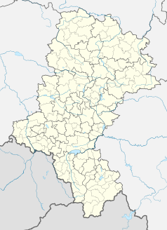
Położenie na mapie Polski (c) Karte: NordNordWest, Lizenz: Creative Commons by-sa-3.0 de | ||||
Borowno-Gajówka – osada leśna w Polsce położona w województwie śląskim, w powiecie częstochowskim, w gminie Mykanów.
Bibliografia
Media użyte na tej stronie
Poland adm location map.svg
(c) Karte: NordNordWest, Lizenz: Creative Commons by-sa-3.0 de
Location map of Poland
(c) Karte: NordNordWest, Lizenz: Creative Commons by-sa-3.0 de
Location map of Poland
Silesian Voivodeship location map2.svg
Autor: SANtosito, Licencja: CC BY-SA 4.0
Location map of en:Silesian Voivodeship with counties (powiats) and municipalities (gminas). Geographic limits of the map:
Autor: SANtosito, Licencja: CC BY-SA 4.0
Location map of en:Silesian Voivodeship with counties (powiats) and municipalities (gminas). Geographic limits of the map:
- N: 51.1617 N
- S: 49.2956 N
- W: 17.8872 E
- E: 20.0559 E
Częstochowa County location map02.svg
Autor: SANtosito, Licencja: CC BY-SA 4.0
Location map of Częstochowa County with urbanized area highlighted. Geographic limits of the map:
Autor: SANtosito, Licencja: CC BY-SA 4.0
Location map of Częstochowa County with urbanized area highlighted. Geographic limits of the map:
- N: 51.06 N
- S: 50.61 N
- W: 18.82 E
- E: 19.85E


