Brégnier-Cordon
| miejscowość i gmina | |||
 Brégnier-Cordon (2011 r.) | |||
| |||
| Państwo | |||
|---|---|---|---|
| Region | |||
| Departament | |||
| Okręg | |||
| Kanton | |||
| Kod INSEE | 01058 | ||
| Mer | Raynald Chahine (2014-2020) | ||
| Powierzchnia | 11,6 km² | ||
| Wysokość | 203-460 m n.p.m. | ||
| Populacja (2012) • liczba ludności |
| ||
| • gęstość | 78,8 os./km² | ||
| Kod pocztowy | 01300 | ||
| Strona internetowa | |||
| Portal | |||
Brégnier-Cordon – miejscowość i gmina we Francji, w regionie Owernia-Rodan-Alpy, w departamencie Ain.
Demografia
Według danych na styczeń 2012 r. gminę zamieszkiwało 914 osób, a gęstość zaludnienia wynosiła 78,8 osób/km².
Bibliografia
Linki zewnętrzne
Media użyte na tej stronie
Autor: Superbenjamin, Licencja: CC BY-SA 4.0
Blank administrative map of France for geo-location purpose, with regions and departements distinguished. Approximate scale : 1:3,000,000
Autor: Flappiefh, Licencja: CC BY-SA 4.0
Carte administrative vierge de la région Auvergne-Rhône-Alpes, France, destinée à la géolocalisation.
Autor: Michiel1972, Licencja: CC BY-SA 3.0
Population - Municipality code 01058.svg
Population Census 1962-2008Autor: Chatsam, Licencja: CC BY-SA 3.0
blason de la commune de Brégnier-Cordon : D'azur aux lettres capitales B et C rangées en bande et entrelacées d'argent.
Autor: Stéphane Batigne, Licencja: CC BY 3.0
Vue de Brégnier-Cordon (Ain), avec le hameau de La Bruyère au premier plan, celui de Brégnier autour de l'église. En bas de l'image, le canal de dérivation de Brégnier-Cordon. Photo prise du sommet du mont de Cordon.
Autor: Flappiefh, Licencja: CC BY-SA 4.0
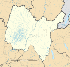
Blank administrative map of the department of Ain, France, for geo-location purpose.


