Brammah
| ||
 | ||
| Państwo | ||
|---|---|---|
| Pasmo | Himalaje | |
| Wysokość | 6416 m n.p.m. | |
| Pierwsze wejście | 24 sierpnia 1973 Chris Bonington, Nick Estcourt | |
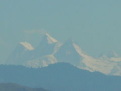
Brammah masyw górski w Himalajach na terenie Indii. Składa się z czterech wierzchołków (z zachodu na wschód):
- Brammah I, 6416 m n.p.m., zdobyty w 1973,
- Flat Top, 6103 m n.p.m., zdobyty w 1980,
- Brammah II, 6485 m n.p.m., zdobyty w 1975,
- Arjuna, 6230 m n.p.m., zdobyty w 1983.
Najwyższym szczytem masywu jest Brammah II – nazwany niezgodnie z praktyką, ponieważ to Brammah I najbardziej wyróżnia się pod względem wysokości w stosunku do okolicy i był pierwszym celem wspinaczki z całego masywu.
Media użyte na tej stronie
The Flag of India. The colours are saffron, white and green. The navy blue wheel in the center of the flag has a diameter approximately the width of the white band and is called Ashoka's Dharma Chakra, with 24 spokes (after Ashoka, the Great). Each spoke depicts one hour of the day, portraying the prevalence of righteousness all 24 hours of it.
Black up-pointing triangle ▲, U+25B2 from Unicode-Block Geometric Shapes (25A0–25FF)
Autor: Uwe Dedering, Licencja: CC BY-SA 3.0
Location map of India.
Equirectangular projection. Stretched by 106.0%. Geographic limits of the map:
- N: 37.5° N
- S: 5.0° N
- W: 67.0° E
- E: 99.0° E
Autor:
- India_Jammu_and_Kashmir_location_map.svg: NordNordWest
- derivative work: Avoided blue (talk)
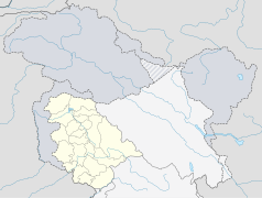
Location map of Jammu and Kashmir, India. De facto situation.
Autor: Oryginalnym przesyłającym był Extremehimalayan z angielskiej Wikipedii, Licencja: FAL
Author-Dr Thakur Naveen Kotwal Brahma 1 and 2 peaks of the kishtwar Himalayas , as seen from Natha top. (J&K,India.)


