Bristol Parkway
 | |
| Państwo | |
|---|---|
| Kraj | |
| Miejscowość | |
| Zarządca | First Great Western[1] |
| Data otwarcia | 1972 |
| Dane techniczne | |
| Liczba peronów | 2 |
| Liczba krawędzi peronowych | 4 |
| Kasy |
|
| Linie kolejowe | |
| |
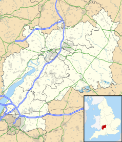
Położenie na mapie Gloucestershire Contains Ordnance Survey data © Crown copyright and database right, CC BY-SA 3.0 | |
Położenie na mapie Wielkiej Brytanii (c) Karte: NordNordWest, Lizenz: Creative Commons by-sa-3.0 de | |
| Portal | |
Bristol Parkway (Bristol Parkway railway station) – stacja kolejowa w Bristolu (administracyjnie leżąca jednak w hrabstwie Gloucestershire), w Anglii. Posiada 2 perony i obsługuje 1,293 mln pasażerów rocznie. Do jesieni 2017 istniały tu 3 krawędzie peronowe, oznaczone numerami 2, 3, 4, po przebudowie jednego z peronów dodano nową krawędź i nadano jej numer 1.
Przypisy
- ↑ Bristol Parkway (BPW) (ang.). National Rail. [dostęp 2011-06-30].
Media użyte na tej stronie
Contains Ordnance Survey data © Crown copyright and database right, CC BY-SA 3.0
Map of Gloucestershire, UK with the following information shown:
- Administrative borders
- Coastline, lakes and rivers
- Roads and railways
- Urban areas
Equirectangular map projection on WGS 84 datum, with N/S stretched 160%
Geographic limits:
- West: 2.70W
- East: 1.60W
- North: 52.16N
- South: 51.36N
(c) Karte: NordNordWest, Lizenz: Creative Commons by-sa-3.0 de
Location map of the United Kingdom
Flag of England. Saint George's cross (a red cross on a white background), used as the Flag of England, the Italian city of Genoa and various other places.
Autor: MGalloway (WMF), Licencja: CC BY-SA 3.0
A tickmark icon included in the OOjs UI MediaWiki lib.
Autor: MGalloway (WMF), Licencja: CC BY-SA 3.0
A tickmark icon included in the OOjs UI MediaWiki lib.
Autor: Hugh Llewelyn , Licencja: CC BY-SA 2.0
Bristol Parkway 7/09.


