Brunehaut
Droga z widocznym z prawej strony menhirem Pierre Brunehaut | |||
| |||
| Państwo | |||
|---|---|---|---|
| Region | |||
| Prowincja | Hainaut | ||
| Dystrykt | |||
| Burmistrz | Pierre Wacquiez | ||
| Powierzchnia | 46,11 km² | ||
| Populacja (2017[1]) • liczba ludności • gęstość |
| ||
| Nr kierunkowy | 069 | ||
| Kod pocztowy | 7620-7624 | ||
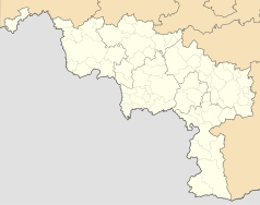
Położenie na mapie Belgii (c) Karte: NordNordWest, Lizenz: Creative Commons by-sa-3.0 de | |||
| Strona internetowa | |||
Brunehaut – gmina w Belgii, w prowincji Hainaut. 7 889 tys. mieszkańców (2012). Łączna powierzchnia wynosi 46,11 km², co daje 170 osoby/km².
Składa się z dziewięciu części: Brunehaut, Bléharies, Guignies, Hollain, Jollain-Merlin, Wez-Velvain, Lesdain, Laplaigne, Rongy i Howardries.
Miasta partnerskie
 Sallenelles
 Amfreville
 Aubigny-en-Artois
Przypisy
- ↑ Stan na 1 stycznia 2017 roku, Direction générale Institutions et Population: Chiffres de la population par province et par commune, à la date du premier janvier 2017. [dostęp 2017-01-01]. (fr.).
Media użyte na tej stronie
(c) Karte: NordNordWest, Lizenz: Creative Commons by-sa-3.0 de
Location map of Belgium
Autor: Milenioscuro, Licencja: CC BY-SA 3.0
Location map of Hainaut province, Belgium
(c) Jean-Pol Grandmont, CC BY 2.5
The Pierre Brunehaut megalith, Brunehaut, Hainaut, Belgium.
d'or à la bande de gueules chargée de trois coquilles d'argent


