Budleigh Salterton
 Plaża w Budleigh Salterton | |
| Państwo | |
|---|---|
| Kraj | |
| Hrabstwo | |
| Dystrykt | |
| Wysokość | 0-2 m n.p.m. |
| Populacja (2011) • liczba ludności |
|
| Nr kierunkowy | 01395 |
| Kod pocztowy | EX9 |
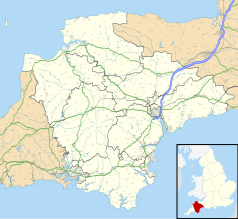
Położenie na mapie Devonu Contains Ordnance Survey data © Crown copyright and database right, CC BY-SA 3.0 | |
Położenie na mapie Wielkiej Brytanii (c) Karte: NordNordWest, Lizenz: Creative Commons by-sa-3.0 de | |
| Strona internetowa | |
| Portal | |
Budleigh Salterton – miasto w południowo-zachodniej Anglii (Wielka Brytania), w hrabstwie Devon, w dystrykcie East Devon, położone nad kanałem La Manche, nad ujściem rzeki Otter, około 10 km na wschód od Exmouth. W 2011 roku liczyło 5185 mieszkańców[1]. Popularna miejscowość wypoczynku letniego, miejsce urodzenia Waltera Raleigha.
Turystyka
Miasto znajduje się na zachodnim krańcu Wybrzeża Jurajskiego, na trasie szlaku turystycznego South West Coast Path. Jedna z nielicznych na południowo-zachodnim wybrzeżu publicznych plaż naturystycznych[2] i jedyna w hrabstwie Devon o oficjalnie potwierdzonym statusie[3].
Miasto partnerskie
 Brewster, Massachusetts
Przypisy
- ↑ Budleigh Salterton Built-up area Local Area Report (ang.). Nomis - Official labour market statistics. [dostęp 2022-06-08].
- ↑ Budleigh Salterton, East Devon (ang.). [dostęp 2008-09-14]. [zarchiwizowane z tego adresu (2008-08-27)].
- ↑ BBC News: Naturist zone decision is delayed (ang.). [dostęp 2008-09-14].
Media użyte na tej stronie
(c) Karte: NordNordWest, Lizenz: Creative Commons by-sa-3.0 de
Location map of the United Kingdom
Flag of England. Saint George's cross (a red cross on a white background), used as the Flag of England, the Italian city of Genoa and various other places.
The flag of Navassa Island is simply the United States flag. It does not have a "local" flag or "unofficial" flag; it is an uninhabited island. The version with a profile view was based on Flags of the World and as a fictional design has no status warranting a place on any Wiki. It was made up by a random person with no connection to the island, it has never flown on the island, and it has never received any sort of recognition or validation by any authority. The person quoted on that page has no authority to bestow a flag, "unofficial" or otherwise, on the island.
Contains Ordnance Survey data © Crown copyright and database right, CC BY-SA 3.0
Map of Devon, UK with the following information shown:
- Administrative borders
- Coastline, lakes and rivers
- Motorways and primary routes
- Urban areas
Equirectangular map projection on WGS 84 datum, with N/S stretched 150%
Geographic limits:
- West: 4.72W
- East: 2.86W
- North: 51.3N
- South: 50.16N
Autor: Herbythyme, Licencja: CC BY-SA 4.0
The beach at Budleigh Salterton in Devon, UK looking east from the town.


