Buren
| |||||
(c) I, China Crisis, CC BY-SA 3.0 Rijswik | |||||
| |||||
| Państwo | |||||
| Prowincja | |||||
| Burmistrz | Jan de Boer (2014)[1] | ||||
| Powierzchnia | 142,93 km² | ||||
| Populacja (2008) • liczba ludności • gęstość | 25 687 191 os./km² | ||||
| Nr kierunkowy | 0344, 0345 | ||||
| Kod pocztowy | 4010-4012, 4016, 4020-4021, 4023-4024, 4030-4033, 4110-4112, 4115-4117, 4119 | ||||
| Strona internetowa | |||||
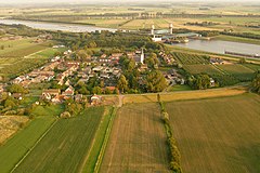
Buren − miasto i gmina w środkowej Holandii (prowincja Geldria). Liczy ok. 25 tys. mieszkańców (2008).
Przypisy
- ↑ buren.nl: Samenstelling college (niderl.). [dostęp 2014-07-10]. [zarchiwizowane z tego adresu (2014-07-14)].
Media użyte na tej stronie
(c) I, China Crisis, CC BY-SA 3.0
Rijswijk, a village in the municipality of Buren, the Netherlands.
Coat of arms of Buren (Netherlands).
Flag of the Dutch municipality of Buren, Gelderland, the Netherlands.
Autor: Erik Frohne, Licencja: CC BY-SA 3.0
Location map of province Gelderland in the Netherlands
Equirectangular projection, N/S stretching 163 %. Geographic limits of the map:
- N: 52.522° N
- S: 51.731° N
- W: 4.989° E
- E: 6.834° E


