Céret (gmina)
| miejscowość i gmina | |||
 Céret (2010) | |||
| |||
| Państwo | |||
|---|---|---|---|
| Region | |||
| Departament | |||
| Okręg | |||
| Kod INSEE | 66049 | ||
| Powierzchnia | 37,86 km² | ||
| Populacja (2011) • liczba ludności |
| ||
| • gęstość | 200 os./km² | ||
| Kod pocztowy | 66400 | ||
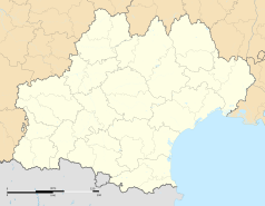
Położenie na mapie Pirenejów Wschodnich © Hawk-Eye, CC BY-SA 3.0 | |||
| Strona internetowa | |||
| Portal | |||
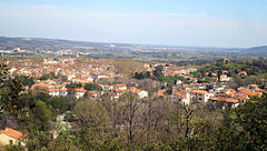
Céret – miejscowość i gmina we Francji, w regionie Oksytania, w departamencie Pireneje Wschodnie, położone nad rzeką Tech.
Według danych na rok 1990 gminę zamieszkiwało 7285 osób, a gęstość zaludnienia wynosiła 192 osoby/km² (wśród 1545 gmin Langwedocji-Roussillon Céret plasuje się na 32. miejscu pod względem liczby ludności, natomiast pod względem powierzchni na miejscu 110.).
Populacja
Zabytki
Zabytki na terenie gminy posiadające status monument historique[1]:
- zamek Aubiry (Château d'Aubiry)
- kościół św. Piotra (Église Saint-Pierre de Céret)
- Fontaine des Neuf Jets
- Monument aux morts de Céret
- Pont du Diable
- Portal de France
Współpraca
Galeria
Przypisy
- ↑ Monuments historiques de Pyrénées-Orientales (fr.). culture.gouv.fr. [dostęp 2016-06-17].
Bibliografia
- Francuski urząd statystyczny (fr.).
Linki zewnętrzne
Media użyte na tej stronie
Autor: Superbenjamin, Licencja: CC BY-SA 4.0
Blank administrative map of France for geo-location purpose, with regions and departements distinguished. Approximate scale : 1:3,000,000
Autor: Flappiefh, Licencja: CC BY-SA 4.0
Carte administrative vierge de la région Languedoc-Roussillon-Midi-Pyrénées, France, destinée à la géolocalisation.
Autor: Pedro A. Gracia Fajardo, escudo de Manual de Imagen Institucional de la Administración General del Estado, Licencja: CC0
Flaga Hiszpanii
Autor: Tubamirum, Licencja: CC BY-SA 3.0
Le Pont du Diable, Céret, Pyrénées orientales
Autor: Palauenc05, Licencja: CC BY-SA 4.0
Coat of arms of the town of Céret (France), crossed keys surrounded by two Putti holding a crown. Dated 1723.
Autor: Michiel1972, Licencja: CC BY-SA 3.0
Population - Municipality code 66049.svg
Population Census 1962-2008© Hawk-Eye, CC BY-SA 3.0
Blank administrative map of the department of Pyrénées-Orientales, France, for geo-location purpose.
Autor: Fabricio Cardenas, Licencja: CC BY-SA 3.0
Vue panoramique de Céret depuis le nord


