Cabimas
 | |||||
| Państwo | |||||
|---|---|---|---|---|---|
| Stan | |||||
| Data założenia | 1758 | ||||
| Burmistrz | Felix Bracho | ||||
| Powierzchnia | 862 km² | ||||
| Wysokość | 3 m n.p.m. | ||||
| Populacja (2013) • liczba ludności • gęstość |
| ||||
| Nr kierunkowy | 264 | ||||
| Kod pocztowy | 4013 | ||||
 | |||||
| Strona internetowa | |||||
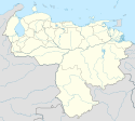
Cabimas − miasto w Wenezueli, w stanie Zulia, położone w północno-zachodniej części kraju, nad Jeziorem Maracaibo.
Osada założona została w 1758 roku.
Ośrodek wydobycia i rafinacji ropy naftowej, port eksportu ropy naftowej i jej przetworów.
Linki zewnętrzne
- Strona o mieście Cabimas. cabimas-zulia.gob.ve. [zarchiwizowane z tego adresu (2007-07-01)].
- [1]
Media użyte na tej stronie
Mapa de la ciudad de Cabimas, municipio Cabimas, Estado Zulia, Venezuela, donde se muestra además la isla artificial de La Salina
Escudo de armas del Municipio Cabimas, estado Zulia, Venezuela
Autor: Andrés González, Licencja: CC BY-SA 3.0
Cathedral of Our Lady of the Rosary of Cabimas. See of the Roman Catholic Diocese of Cabimas. Its located on the corner of Independencia street with Miranda street in Cabimas, Zulia, Venezuela. The church was built in 1829 by initiative of Mrs Juana Villazmil and remodeled to its current form in 1965. At the right corner a Cabimas tree is visible, the city is named after the tree. To the right of the church you can see the parsonage, and to the left of the church you can see the see of the Carmen Herrera civil parish and Cabimas postal service headquarters with a cross on the roof.
Flag Cabimas, Venezuela


