Caborca
 | |||
| |||
| Państwo | |||
|---|---|---|---|
| Stan | |||
| Gmina | Caborca | ||
| Data założenia | 1688 | ||
| Burmistrz | Darío Murillo Bolaños | ||
| Wysokość | 275[1] m n.p.m. | ||
| Populacja (2010) • liczba ludności |
| ||
| Nr kierunkowy | 637 | ||
| Kod pocztowy | 83600-83699[3] | ||
| Tablice rejestracyjne | 26 | ||
| Strona internetowa | |||
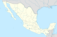
Caborca, Heroica Caborca – miasto w środkowej części meksykańskiego stanu Sonora, siedziba władz gminy Caborca. Miejscowość jest położona na pustynnej nizinie, na wysokości 275 m n.p.m. Caborca leży około 170 km na północ od stolicy stanu Hermosillo i około 75 km od wybrzeża Zatoki Kalifornijskiej. W 2010 roku ludność miejscowości liczyła 52 330 mieszkańców[2]. Miejscowość została założona w 1688 roku przez Jezuitę - Eusebio Francisco Kino[4].
Współpraca
 Puerto Peñasco, Meksyk
 Culiacán, Meksyk
 San Luis Potosí, Meksyk
 Tepic, Meksyk
 Acaponeta, Meksyk
 Prescott, Stany Zjednoczone
 Upland, Stany Zjednoczone
 Turlock, Stany Zjednoczone
 Porterville, Stany Zjednoczone
 Albany, Stany Zjednoczone
 Green Bay, Stany Zjednoczone
 Tucson, Stany Zjednoczone
 Paryż, Francja
Przypisy
- ↑ DB City - Caborca. [dostęp 2014-09-30]. (ang.).
- ↑ a b Strona Meksykańskiego Instytutu Statystycznego (INEGI) - Sonora Poblacion 2010. [dostęp 2014-09-30]. (hiszp.).
- ↑ Geo Postcodes - Mexico, Sonora. [dostęp 2014-09-30]. (ang.).
- ↑ Encyklopedia Gmin Meksyku - Sonora. [dostęp 2014-09-30]. (hiszp.).
Media użyte na tej stronie
The flag of Navassa Island is simply the United States flag. It does not have a "local" flag or "unofficial" flag; it is an uninhabited island. The version with a profile view was based on Flags of the World and as a fictional design has no status warranting a place on any Wiki. It was made up by a random person with no connection to the island, it has never flown on the island, and it has never received any sort of recognition or validation by any authority. The person quoted on that page has no authority to bestow a flag, "unofficial" or otherwise, on the island.
The municipal coat of arms of Caborca has the following characteristics: it has the vertical rectangle, figured by two trapezoids and a triangle. The line is a vertical integration that bifurcates at 45 degrees to form the lower triangle, where the image appears Historic church of Nuestra Senora de la Concepcion de Caborca, is a drawing done by computer as the sun and the saguaro, appearing in the left trapezius and right respectively. The predominant colors of the municipal shield are: on a black background, which in turn provides a framework and standard, vertical rectangle is viewed, the left trapezius is green and serves as background to the figure of the sun, which appears in yellow, the right trapezius is white and appears saguaro is green, the lower triangle is black and is part of the background and context of a shield. About this triangle is embedded white color, the stylized picture of the Temple Historic Caborca.
Autor: Victor.montanoo, Licencja: CC BY-SA 3.0
iglesia de nuestra señora de la purisima concepción de caborca


