Caerphilly
 | |
| Państwo | |
|---|---|
| Księstwo | |
| Hrabstwo | |
| Populacja • liczba ludności |
|
| Nr kierunkowy | 029 |
| Kod pocztowy | CF83 |
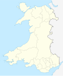
Położenie na mapie Caerphilly Contains Ordnance Survey data © Crown copyright and database right, CC BY-SA 3.0 | |
Położenie na mapie Wielkiej Brytanii (c) Karte: NordNordWest, Lizenz: Creative Commons by-sa-3.0 de | |
| Strona internetowa | |
| Portal | |
Caerphilly (IPA: [kɛəˈfɪli], wal. Caerffili IPA: [ˌkɑːɨrˈfɪlɪ]) − miasto w Walii, w zespole miejskim Cardiff, około 28 tysięcy mieszkańców w roku 2003.
Co roku w lipcu odbywa się tu festiwal „The Big Cheese”[1]
Zabytki
- Zamek Caerphilly – największy zamek w Walii i drugi co do wielkości w Wielkiej Brytanii (po Zamku Windsorskim)
Miasta partnerskie
Zobacz też
- Caerphilly (ser)
Przypisy
- ↑ Strona festiwalu „The Big Cheese”. [dostęp 2010-04-24]. (ang.).
Media użyte na tej stronie
(c) Karte: NordNordWest, Lizenz: Creative Commons by-sa-3.0 de
Location map of the United Kingdom
(c) Peter Wasp, CC BY-SA 2.0
Caerphilly Miners Hospital Caerphilly District Miners Hospital is located on Watford Road and is part of Gwent Healthcare NHS Trust
Autor: NordNordWest, Licencja: CC BY-SA 3.0
Location map of Wales, United Kingdom
Autor: Phillip Capper z Wellington, New Zealand, Licencja: CC BY 2.0
Caerphilly Castle in Wales
Caerphilly Castle, Wales
Contains Ordnance Survey data © Crown copyright and database right, CC BY-SA 3.0
Blank map of Caerphilly, UK with the following information shown:
- Administrative borders
- Coastline, lakes and rivers
- Roads and railways
- Urban areas
Equirectangular map projection on WGS 84 datum, with N/S stretched 160%
Geographic limits:
- West: 3.40W
- East: 3.05W
- North: 51.83N
- South: 51.52N


