Caledonian Road & Barnsbury
| ||
 Perony stacji | ||
| Państwo | ||
| Miejscowość | Londyn | |
| Lokalizacja | London Borough of Islington | |
| Zarządca | ||
| Dane techniczne | ||
| Liczba peronów | 2 | |
| Linie kolejowe | ||
| ||
Położenie na mapie gminy Islington  Contains Ordnance Survey data © Crown copyright and database right, CC BY-SA 3.0 | ||
Położenie na mapie Wielkiej Brytanii  (c) Karte: NordNordWest, Lizenz: Creative Commons by-sa-3.0 de | ||
Położenie na mapie Anglii  | ||
Położenie na mapie Wielkiego Londynu  Contains Ordnance Survey data © Crown copyright and database right, CC BY-SA 3.0 | ||
| Portal | ||
Caledonian Road & Barnsbury – stacja kolejowa w Londynie, na terenie London Borough of Islington, zarządzana i obsługiwana przez London Overground[1] jako część North London Line. W roku statystycznym 2006/07 skorzystało z niej ok. 442 tysiące pasażerów[2].
Galeria
Tablica z logo stacji

Główne wejście na stację

Pociąg typu British Rail Class 378 podczas postoju na stacji
Przypisy
- ↑ National Rail Enquiries - Station Facilities for Caledonian Rd & Barnsbury. [dostęp 2010-12-19].
- ↑ Dane: Office for Rail Regulation [dostęp 2010-12-19]
| Gospel Oak – Barking |
|
|---|---|
| North London Line |
|
| South London Line |
|
| Watford DC Line | |
| West London Line |
|
| East London Line |
![]()
Media użyte na tej stronie
United Kingdom adm location map.svg
(c) Karte: NordNordWest, Lizenz: Creative Commons by-sa-3.0 de
Location map of the United Kingdom
(c) Karte: NordNordWest, Lizenz: Creative Commons by-sa-3.0 de
Location map of the United Kingdom
Greater London UK location map 2.svg
Contains Ordnance Survey data © Crown copyright and database right, CC BY-SA 3.0
Contains Ordnance Survey data © Crown copyright and database right, CC BY-SA 3.0
Map of Greater London, UK with the following information shown:
- Administrative borders
- Coastline, lakes and rivers
- Roads and railways
- Urban areas
The data includes both primary routes and railway lines.
Equirectangular map projection on WGS 84 datum, with N/S stretched 160%
Geographic limits:
- West: 0.57W
- East: 0.37E
- North: 51.72N
- South: 51.25N

Caledonian Road & Barnsbury stn high eastbound.JPG
Autor: Sunil060902, Licencja: CC BY-SA 3.0
Caledonian Road & Barnsbury station looking east from footbridge (single AC-electrified freight line can be seen on the far left).
Autor: Sunil060902, Licencja: CC BY-SA 3.0
Caledonian Road & Barnsbury station looking east from footbridge (single AC-electrified freight line can be seen on the far left).
Islington London UK blank ward map.svg
Contains Ordnance Survey data © Crown copyright and database right, CC BY-SA 3.0
Contains Ordnance Survey data © Crown copyright and database right, CC BY-SA 3.0
Blank map of the London Borough of Islington, showing electoral wards.
Equirectangular map projection on WGS 84 datum, with N/S stretched 160%
Geographic limits:
- West: 0.15W
- East: 0.07W
- North: 51.58N
- South: 51.515N
London Overground logo.svg
This is a logo owned by Transport for London for London Overground.
This is a logo owned by Transport for London for London Overground.

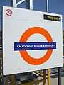
Caledonian Road & Barnsbury stn roundel.jpg
Autor: Sunil060902, Licencja: CC BY-SA 3.0
Caledonian Road & Barnsbury station roundel in Overground orange, installed on the rebuilt platforms (2010)
Autor: Sunil060902, Licencja: CC BY-SA 3.0
Caledonian Road & Barnsbury station roundel in Overground orange, installed on the rebuilt platforms (2010)

Unit 378024 at Caledonian Road & Barnsbury.jpg
Autor: Sunil060902, Licencja: CC BY-SA 3.0
Class 378 unit 378024 arrives at Caledonian Road & Barnsbury with a Richmond service soon after re-opening in June 2010.
Autor: Sunil060902, Licencja: CC BY-SA 3.0
Class 378 unit 378024 arrives at Caledonian Road & Barnsbury with a Richmond service soon after re-opening in June 2010.

Caledonian Road & Barnsbury stn main entrance.JPG
Autor: Sunil060902, Licencja: CC BY-SA 3.0
Caledonian Road & Barnsbury station main entrance
Autor: Sunil060902, Licencja: CC BY-SA 3.0
Caledonian Road & Barnsbury station main entrance