Camaragibe
| |||
 | |||
| |||
| Państwo | |||
| Stan | |||
| Data założenia | 13 maja 1982 | ||
| Burmistrz | Jorge Alexandre | ||
| Powierzchnia | 55,083 km² | ||
| Wysokość | 55 m n.p.m. | ||
| Populacja (2011) • liczba ludności • gęstość | 145 676 2 644,66 os./km² | ||
| Nr kierunkowy | 81 | ||
| Strona internetowa | |||
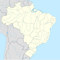
Camaragibe − miasto w Brazylii, w stanie Pernambuco.
Media użyte na tej stronie
Brazil Pernambuco location map.svg
Autor: Milenioscuro, Licencja: CC BY-SA 3.0
Location map of Pernambuco state. Geographic limits of the map:
Autor: Milenioscuro, Licencja: CC BY-SA 3.0
Location map of Pernambuco state. Geographic limits of the map:
- N: 7.034° S
- S: 9.735° S
- W: 41.573° W
- E: 34.392° W
Inset of Ilha Fernando de Noronha at lower right (x = 92.8% to 100%, y = 86.73 to 100%):
- N: 3.7727° S
- S: 3.9171° S
- W: 32.5158° W
- E: 32.3456° W
BANDEIRA DE CAMARAGIBE.svg
Bandeira do Município de Camaragibe
Bandeira do Município de Camaragibe
Bandeira de Pernambuco.svg
Flag of the State of Pernambuco, Brazil.
Flag of the State of Pernambuco, Brazil.


