Camas (Waszyngton)
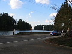
 Jezioro Lacamas | |
| Państwo | |
|---|---|
| Stan | |
| Hrabstwo | |
| Powierzchnia | 39,5 km² |
| Populacja • liczba ludności |
|
| Nr kierunkowy | 360 |
| Kod pocztowy | 98607 |
| Strona internetowa | |
| Portal | |
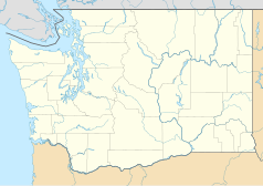
Camas – miasto w Stanach Zjednoczonych, w stanie Waszyngton, w hrabstwie Clark nad rzeką Kolumbia. W 2010 r. miejscowość liczyła 19 355 mieszkańców[1].
Nazwa miasta wzięła się od bulw rośliny Camassia. Obszar, w którym rzeka Washougal wpływa do rzeki Kolumbia porastały właśnie kamasje, więc francusko-kanadyjscy traperzy nazwali obszar La Camas. Znajdująca się nieopodal miasta Lady Island (leżąca na rzece Kolumbia) była miejscem prac archeologicznych; odnalezione ceramiczne artefakty wskazują na obecność ludzi w regionie 2500-2000 lat temu. W 1883 roku założono La Camas Colony Company, co poskutkowało wybudowaniem we wrześniu tego roku 60 budynków dla mieszkańców[2].
W 2004 roku Camas oraz Hillsboro podpisały umowę handlową z gminami Zabierzów, Morawica i Krapkowice[3].
Współpraca
Przypisy
- ↑ American FactFinder. [dostęp 2014-03-22]. [zarchiwizowane z tego adresu (18 stycznia 2015)].
- ↑ Camas -- Thumbnail History. HistoryLink, wersja z dnia 17 stycznia 2013.
- ↑ Współpraca polsko-amerykańska. Gmina Zabierzów. [dostęp 2014-03-22].
Linki zewnętrzne
Media użyte na tej stronie
Autor: Uwe Dedering, Licencja: CC BY-SA 3.0
Location map of the USA (without Hawaii and Alaska).
EquiDistantConicProjection:
Central parallel:
* N: 37.0° N
Central meridian:
* E: 96.0° W
Standard parallels:
* 1: 32.0° N
* 2: 42.0° N
Made with Natural Earth. Free vector and raster map data @ naturalearthdata.com.
Formulas for x and y:
x = 50.0 + 124.03149777329222 * ((1.9694462586094064-({{{2}}}* pi / 180))
      * sin(0.6010514667026994 * ({{{3}}} + 96) * pi / 180))
y = 50.0 + 1.6155950752393982 * 124.03149777329222 * 0.02613325650382181
      - 1.6155950752393982  * 124.03149777329222 *
     (1.3236744353715044  - (1.9694462586094064-({{{2}}}* pi / 180))
      * cos(0.6010514667026994 * ({{{3}}} + 96) * pi / 180))
The flag of Navassa Island is simply the United States flag. It does not have a "local" flag or "unofficial" flag; it is an uninhabited island. The version with a profile view was based on Flags of the World and as a fictional design has no status warranting a place on any Wiki. It was made up by a random person with no connection to the island, it has never flown on the island, and it has never received any sort of recognition or validation by any authority. The person quoted on that page has no authority to bestow a flag, "unofficial" or otherwise, on the island.
Autor: Alexrk2, Licencja: CC BY 3.0
Ta mapa została stworzona za pomocą GeoTools.
Children fish while standing on the SR 500 bridge over the intersection of Lacamas Lake and Round Lake in Washington. The camera was positioned in the parking lot of Lacamas Park and was facing west.


