Capelle aan den IJssel
 Plan Capelle aan den IJssel (2013) | |||||
| |||||
| Państwo | |||||
|---|---|---|---|---|---|
| Prowincja | Holandia Południowa | ||||
| Burmistrz | Frank Koen (2014)[1] | ||||
| Powierzchnia | 15,40 km² | ||||
| Populacja • liczba ludności | 66 024[2] | ||||
| Nr kierunkowy | 010 | ||||
| Kod pocztowy | 2900–2908 | ||||
| Tablice rejestracyjne | H | ||||
| Strona internetowa | |||||
Capelle aan den IJssel – miasto i gmina w Holandii, w prowincji Holandia Południowa. Miasto położone jest w zespole miejskim Rotterdamu, przy ujściu rzeki Hollandse IJssel do Nowej Mozy. Jego liczba ludności wynosi 66 024.
Do miasta dociera jedna z linii metra w Rotterdamie, w obrębie miejscowości znajduje się także przystanek kolejowy Capelle Schollevaar, a w bezpośrednim pobliżu biegną autostrady A16 i A20.
Ludzie związani z Capelle aan den IJssel
Przypisy
- ↑ capelleaandenijssel.nl: Burgemeester (niderl.). [dostęp 2014-07-17]. [zarchiwizowane z tego adresu (2013-11-20)].
- ↑ Alle 408 gemeenten in 2013 (niderl.). kpn.nl. [dostęp 2013-11-03].
Media użyte na tej stronie
Coat of arms of the Dutch municipality of Capelle aan den IJssel, South Holland.
Autor: Erik Frohne, Licencja: CC BY-SA 3.0
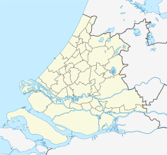
Location map of province South Holland in the Netherlands
Equirectangular projection, N/S stretching 162 %. Geographic limits of the map:
- N: 52.40° N
- S: 51.60° N
- W: 3.80° E
- E: 5.20° E
Autor: Janwillemvanaalst, Licencja: CC BY-SA 3.0
Topografische kaart van gemeente Capelle aan den IJssel (2013).
Samengesteld door Jan-Willem van Aalst op basis van de GML open geodata van de BRT/Top10NL (basisregistratie Topografie, Kadaster 2011), vrijgegeven door Kadaster onder de Creative Commons BY licentie. Additionele gegevens uit BAG (8 juli 2013), uit de Open Street Map (9 juli 2013) en uit de Risicokaart. Peildatum kaartbeeld: 9 juli 2013. Zie ook Gemeentenatlas.nl
Samenstelling en kleurenschema: Jan-Willem van Aalst, met QuantumGIS en Photoshop. Zie ook de Legenda.


