Cargèse
| gmina | |||
 | |||
| |||
| Państwo | |||
|---|---|---|---|
| Region | |||
| Departament | |||
| Okręg | |||
| Kod INSEE | 2A065 | ||
| Powierzchnia | 45,99 km² | ||
| Populacja (1998) • liczba ludności |
| ||
| • gęstość | 21 os./km² | ||
| Kod pocztowy | 20130 | ||
| Portal | |||
Cargèse (korsyk. Carghjese) to miejscowość i gmina we Francji, w regionie Korsyka, w departamencie Korsyka Południowa.
Według danych na rok 1998 gminę zamieszkiwały 982 osoby, a gęstość zaludnienia wynosiła 21 osób/km².
Znajduje się tu cerkiew św. Spirydiona należąca do parafii Greckiego Kościoła katolickiego.
Zobacz też
Linki zewnętrzne
- Cargèse na mapie Mapquest'u
- Gmina Cargèse (strona oficjalna). corsica.net. [zarchiwizowane z tego adresu (2016-08-06)].
- Gmina Cargèse
- greckie Cargèse
- Instytut Studiów Naukowych w Cargese
Bibliografia
- Francuski urząd statystyczny. (fr.).
Media użyte na tej stronie
Autor: Superbenjamin, Licencja: CC BY-SA 4.0
Blank administrative map of France for geo-location purpose, with regions and departements distinguished. Approximate scale : 1:3,000,000
Autor: Pierre Bona, Licencja: CC BY-SA 3.0
Cargèse (Corse) - Le quartier au sud-ouest du village avec l'église Latine. Au sommet de la colline, un moulin ruiné
Autor: Tretinville, Licencja: CC BY-SA 3.0
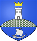
D’azur à la colline d’argent, herbée de sinople, sommée d’une tour d’argent, surmontée d’une couronne d’or ; à la champagne d’azur chargée d’un voilier contourné d’argent.
Autor: Eric Gaba (Sting - fr:Sting), Licencja: CC BY-SA 3.0
Blank administrative map of the department of Corse-du-Sud, France, for geo-location purpose, with distinct boundaries for departments and arrondissements.
Autor: Eric Gaba (Sting - fr:Sting), Licencja: CC BY-SA 3.0
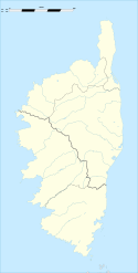
Blank administrative map of the region of Corsica, France, for geo-location purpose, with distinct boundaries for departments and arrondissements as they are since January 2010.
The former version of the map shows the boundaries as they were until December 2009.


