Carnegie Mellon University
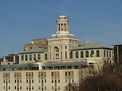
 Hamerschlag Hall (2007) | |
| Data założenia | 1900 |
|---|---|
| Państwo | |
| Adres | Carnegie Mellon University 5000 Forbes Avenue Pittsburgh, PA 15213 |
| Liczba studentów | 9900 |
| Strona internetowa | |
Carnegie Mellon University (Uniwersytet Carnegiego i Mellonów) – amerykański uniwersytet niepubliczny w Pittsburghu.
Historia
W roku 1900 Andrew Carnegie założył zespół szkół o profilu technicznym, które w 1912 przekształciły się w Carnegie Institute of Technology. W 1967 został on połączony z Mellon Institute of Industrial Research i nowej jednostce nadano obecną nazwę (pochodzi ona od nazwisk fundatorów obu części składowych – odpowiednio Andrew Carnegiego oraz braci Andrew Mellona i Richarda Mellona).
Uniwersytet składa się z siedmiu szkół i college’ów:
- Carnegie Institute of Technology
- College of Fine Arts
- College of Humanities and Social Sciences
- Mellon College of Science
- Tepper School of Business
- School of Computer Science
- H. John Heinz III School of Public Policy and Management
Sport
Przy uczelni działa akademicki klub sportowy Carnegie Mellon Tartans, zrzeszony w National Collegiate Athletic Association i występujący w NCAA Division III, a dokładniej w konferencji University Athletic Association.
Laureaci Nagrody Nobla
Absolwenci CMU
- John L. Hall (fizyka, 2005)
- Finn E. Kydland (ekonomia, 2004)
- Edward C. Prescott (ekonomia, 2004)
- Clifford Shull (fizyka, 1994)
- John Nash Jr. (ekonomia, 1994) (bohater filmu Piękny umysł)
Pracujący na CMU
- Clinton Joseph Davisson (fizyka, 1937)
- Otto Stern (fizyka, 1943)
- Paul Flory (chemia, 1974)
- Herbert Simon (ekonomia, 1978)
- Franco Modigliani (ekonomia, 1985)
- Merton Miller (ekonomia, 1990)
- Robert Lucas Jr. (ekonomia, 1995)
- John Pople (chemia, 1998)
- Walter Kohn (chemia, 1998)
- Paul Lauterbur (medycyna, 2003)
- Finn E. Kydland (ekonomia, 2004)
- Edward C. Prescott (ekonomia, 2004)
Linki zewnętrzne
- Oficjalna strona uczelni (ang.)
Media użyte na tej stronie
Autor: Uwe Dedering, Licencja: CC BY-SA 3.0
Location map of the USA (without Hawaii and Alaska).
EquiDistantConicProjection:
Central parallel:
* N: 37.0° N
Central meridian:
* E: 96.0° W
Standard parallels:
* 1: 32.0° N
* 2: 42.0° N
Made with Natural Earth. Free vector and raster map data @ naturalearthdata.com.
Formulas for x and y:
x = 50.0 + 124.03149777329222 * ((1.9694462586094064-({{{2}}}* pi / 180))
      * sin(0.6010514667026994 * ({{{3}}} + 96) * pi / 180))
y = 50.0 + 1.6155950752393982 * 124.03149777329222 * 0.02613325650382181
      - 1.6155950752393982  * 124.03149777329222 *
     (1.3236744353715044  - (1.9694462586094064-({{{2}}}* pi / 180))
      * cos(0.6010514667026994 * ({{{3}}} + 96) * pi / 180))
The flag of Navassa Island is simply the United States flag. It does not have a "local" flag or "unofficial" flag; it is an uninhabited island. The version with a profile view was based on Flags of the World and as a fictional design has no status warranting a place on any Wiki. It was made up by a random person with no connection to the island, it has never flown on the island, and it has never received any sort of recognition or validation by any authority. The person quoted on that page has no authority to bestow a flag, "unofficial" or otherwise, on the island.
Autor: unknown, Licencja:
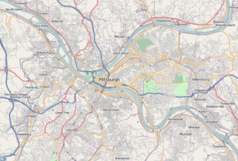
A map of the city of Pittsburgh and its surrounding areas
Autor: Alexrk2, Licencja: CC BY 3.0
Location map of Pennsylvania, USA


