Centre des nouvelles industries et technologies
| Państwo | |
|---|---|
| Miejscowość | Paryż |
| Adres | La Défense |
| Architekt | Robert Camelot, Jean de Mailly, Bernard Zehrfuss, Nicolas Esquillan, Jean Prouvé |
| Wysokość całkowita | 46,3 m |
| Wysokość do dachu | 46,3 m |
| Rozpoczęcie budowy | 1956 |
| Ukończenie budowy | 1958 |
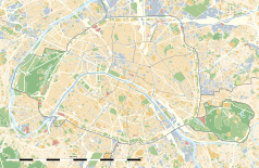
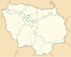
Położenie na mapie Paryża (c) Eric Gaba, Wikimedia Commons user Sting, CC BY-SA 3.0 | |
| Strona internetowa | |
Centre des nouvelles industries et technologies (CNIT) – pierwszy budynek zbudowany w La Défense, na zachodzie Paryża. Swój charakterystyczny kształt zawdzięcza trójkątnej działce, którą zajmuje, zastępując stare fabryki Zodiac na terenie Puteaux. Zbudowany w 1958 roku CNIT przeszedł dwie restrukturyzacje, zakończone w 1988 i 2009 roku[1]. Zarządza nim firma Viparis.
Przypisy
- ↑ CNIT (Centre des Nouvelles Industries et Technologies), Paris La Défense [dostęp 2021-02-18] (fr.).
Linki zewnętrzne
Zobacz też
Media użyte na tej stronie
(c) Eric Gaba, Wikimedia Commons user Sting, CC BY-SA 3.0
Blank land cover map of the city and department of Paris, France, as in January 2012, for geo-location purpose, with distinct boundaries for departments and arrondissements.
Autor: Superbenjamin, Licencja: CC BY-SA 4.0
Blank administrative map of France for geo-location purpose, with regions and departements distinguished. Approximate scale : 1:3,000,000
Autor: Thibault Pelloquin, Licencja: CC BY-SA 3.0
Cette carte représente l'Île de France (en jaune pâle), ses limites départementales et régionales (en traits gris) et ses principaux cours et points d'eau (en bleu). Les départements limitrophes (sont en rose-orange pâle)


