Châtillon-lès-Sons
| miejscowość i gmina | |
 | |
| Państwo | |
|---|---|
| Region | |
| Departament | |
| Okręg | |
| Kanton | Marle |
| Kod INSEE | 02169 |
| Mer | Jean-Paul Vuilliot (2001-2020) |
| Powierzchnia | 10,56 km² |
| Wysokość | 80-151 m n.p.m. |
| Populacja (2014) • liczba ludności |
|
| • gęstość | 8,33 os./km² |
| Kod pocztowy | 02270 |
Położenie na mapie Aisne (c) Eric Gaba, Wikimedia Commons user Sting, CC BY-SA 3.0 | |
| Portal | |
Châtillon-lès-Sons – miejscowość i gmina we Francji, w regionie Hauts-de-France, w departamencie Aisne. Jej merem od marca 2001 roku jest Jean-Paul Vuilliot.
Według danych na styczeń 2014 roku gminę zamieszkiwało 88 osób, a gęstość zaludnienia wynosiła 8,3 osób/km².
Bibliografia
Media użyte na tej stronie
(c) Eric Gaba, Wikimedia Commons user Sting, CC BY-SA 3.0
Blank administrative map of the department of Aisne, France, as in January 2015, for geo-location purpose, with distinct boundaries for regions, departments and arrondissements.
Autor: Superbenjamin, Licencja: CC BY-SA 4.0
Blank administrative map of France for geo-location purpose, with regions and departements distinguished. Approximate scale : 1:3,000,000
Autor: Flappiefh, Licencja: CC BY-SA 4.0
Carte administrative vierge de la région Hauts-de-France, France, destinée à la géolocalisation.
Autor: G.Garitan, Licencja: CC BY-SA 3.0
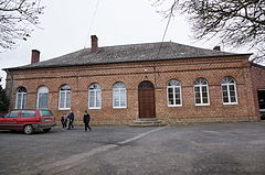
vue de Châtillon-lès-Sons.


