Chantenay-Villedieu
| miejscowość i gmina | |||
 Merostwo | |||
| |||
| Państwo | |||
|---|---|---|---|
| Region | |||
| Departament | |||
| Okręg | |||
| Kod INSEE | 72059 | ||
| Powierzchnia | 28,17 km² | ||
| Populacja (1990) • liczba ludności |
| ||
| • gęstość | 23 os./km² | ||
| Kod pocztowy | 72430 | ||
Położenie na mapie Sarthe (c) Eric Gaba, Wikimedia Commons user Sting, CC BY-SA 3.0 | |||
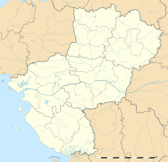
Położenie na mapie Kraju Loary (c) Eric Gaba, Wikimedia Commons user Sting, CC BY-SA 3.0 | |||
| Portal | |||
Chantenay-Villedieu – miejscowość i gmina we Francji, w regionie Kraj Loary, w departamencie Sarthe.
Według danych na rok 1990 gminę zamieszkiwało 648 osób, a gęstość zaludnienia wynosiła 23 osób/km² (wśród 1504 gmin Kraju Loary Chantenay-Villedieu plasuje się na 754. miejscu pod względem liczby ludności, natomiast pod względem powierzchni na miejscu 323.).
Bibliografia
- Francuski urząd statystyczny (fr.).
Media użyte na tej stronie
Autor: Superbenjamin, Licencja: CC BY-SA 4.0
Blank administrative map of France for geo-location purpose, with regions and departements distinguished. Approximate scale : 1:3,000,000
(c) Eric Gaba, Wikimedia Commons user Sting, CC BY-SA 3.0
Blank administrative map of the region of Pays de la Loire, France, as in February 2011, for geo-location purpose, with distinct boundaries for regions, departments and arrondissements.
Autor: Celbusro, Licencja: CC BY-SA 3.0
Blasonnement : D'azur à l'épi de blé d'or en pal, à la marguerite au naturel en bande et au bluet au naturel en barre, mouvant (hissant) tous trois d'une touffe d'herbe de sinople et surmontés d'un poisson en fasce d'argent.
(c) Eric Gaba, Wikimedia Commons user Sting, CC BY-SA 3.0
Blank administrative map of the department of Sarthe, France, as in February 2011, for geo-location purpose, with distinct boundaries for regions, departments and arrondissements.


