Charlestown of Aberlour
(c) Anne Burgess, CC BY-SA 2.0 | |
| Państwo | |
|---|---|
| Hrabstwo | |
| Populacja (2011) • liczba ludności |
|
| Nr kierunkowy | 01340 |
| Kod pocztowy | AB38 |
Położenie na mapie Moray Contains Ordnance Survey data © Crown copyright and database right, CC BY-SA 3.0 | |
Położenie na mapie Wielkiej Brytanii (c) Karte: NordNordWest, Lizenz: Creative Commons by-sa-3.0 de | |
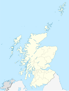
Położenie na mapie Szkocji | |
| Strona internetowa | |
| Portal | |
Charlestown of Aberlou - miasteczko położone w hrabstwie Moray w Szkocji. Zostało założone w 1812 roku[1] W 2011 roku miasto miało 972 mieszkańców.
Przypisy
- ↑ "TALK ON ABERLOUR Prepared by Dr. B.M. Sellar". [dostęp 2019-10-20].
Media użyte na tej stronie
(c) Karte: NordNordWest, Lizenz: Creative Commons by-sa-3.0 de
Location map of the United Kingdom
(c) Eric Gaba, NordNordWest, CC BY-SA 3.0
Location map of Scotland, United Kingdom
(c) Anne Burgess, CC BY-SA 2.0
Aberlour from Wester Elchies. Notice that there is no clock on the church tower. When it was to be built, the people in Aberlour sought a donation from the people across the river. This was not forthcoming, so the clock tower was built with three clocks so that the people across the river would not be able to benefit from the fourth one!
Contains Ordnance Survey data © Crown copyright and database right, CC BY-SA 3.0
Blank map of Moray, UK with the following information shown:
- Administrative borders
- Coastline, lakes and rivers
- Roads and railways
- Urban areas
Equirectangular map projection on WGS 84 datum, with N/S stretched 180%
Geographic limits:
- West: 3.80W
- East: 2.55W
- North: 57.75N
- South: 57.05N


