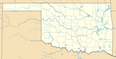
Chesapeake Energy Arena
| ||
 | ||
| Przydomek: The Thunderdome | ||
| Państwo | ||
| Miejscowość | Oklahoma City | |
| Adres | 100 West Reno Avenue, Oklahoma City, Oklahoma 73102[1] | |
| Lata budowy | 1999–2002[2] | |
| Otwarta | 8 czerwca 2002 | |
| Architekt | Sink Combs Dethlefs, The Benham Companies, LLC.[2] | |
| Właściciel | Miasto Oklahoma City[2] | |
| Operator | Spectacor Management Group[2] | |
| Użytkownicy | Oklahoma City Thunder (NBA) (od 2008)[2] | |
| Liczba miejsc | ||
| Stałych | 15 341[2] | |
| Całkowita | hokej: 15 152[2] koszykówka: 18 203[2] piłka nożna: 17 868 koncerty: 16 591[2] WWE: 16 757[2] | |
| Strona internetowa | ||
Chesapeake Energy Arena – wielofunkcyjna hala sportowa znajdująca się w Oklahoma City w stanie Oklahoma w Stanach Zjednoczonych. Została otwarta 8 czerwca 2002 roku[1]. Koszt budowy wyniósł około 89,2 milionów dolarów[1].
Oryginalnie, w latach 2002–10 hala nosiła nazwę Ford Center. Następnie przez rok znana była jako Oklahoma City Arena, a od 2011 funkcjonuje obecna nazwa.
Od 2008 roku swoje mecze na niej rozgrywa występująca w NBA drużyna Oklahoma City Thunder. W latach 2002–09 była domowym obiektem zespołu Oklahoma City Blazers występującego w CHL. W latach 2005–07 swoje domowe mecze rozgrywali na niej zawodnicy New Orleans Hornets z NBA, po uszkodzeniu hali w Nowym Orleanie przez Huragan Katrina.
Przypisy
Linki zewnętrzne
Media użyte na tej stronie
Autor: Alexrk, Licencja: CC BY 3.0
Ta mapa została stworzona za pomocą GeoTools.
Autor: Uwe Dedering, Licencja: CC BY-SA 3.0
Location map of the USA (without Hawaii and Alaska).
EquiDistantConicProjection:
Central parallel:
* N: 37.0° N
Central meridian:
* E: 96.0° W
Standard parallels:
* 1: 32.0° N
* 2: 42.0° N
Made with Natural Earth. Free vector and raster map data @ naturalearthdata.com.
Formulas for x and y:
x = 50.0 + 124.03149777329222 * ((1.9694462586094064-({{{2}}}* pi / 180))
      * sin(0.6010514667026994 * ({{{3}}} + 96) * pi / 180))
y = 50.0 + 1.6155950752393982 * 124.03149777329222 * 0.02613325650382181
      - 1.6155950752393982  * 124.03149777329222 *
     (1.3236744353715044  - (1.9694462586094064-({{{2}}}* pi / 180))
      * cos(0.6010514667026994 * ({{{3}}} + 96) * pi / 180))
The flag of Navassa Island is simply the United States flag. It does not have a "local" flag or "unofficial" flag; it is an uninhabited island. The version with a profile view was based on Flags of the World and as a fictional design has no status warranting a place on any Wiki. It was made up by a random person with no connection to the island, it has never flown on the island, and it has never received any sort of recognition or validation by any authority. The person quoted on that page has no authority to bestow a flag, "unofficial" or otherwise, on the island.
Autor: Urbanative, Licencja: CC BY-SA 3.0
Chesapeake Energy Arena in downtown Oklahoma City.


