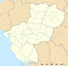
Cholet
| miejscowość i gmina | |||
 | |||
| |||
| Państwo | |||
|---|---|---|---|
| Region | |||
| Departament | |||
| Okręg | |||
| Kod INSEE | 49099 | ||
| Mer | Gilles Bourdouleix (od 1995) | ||
| Powierzchnia | 87,51 km² | ||
| Populacja (2010[1]) • liczba ludności |
| ||
| • gęstość | 618 os./km² | ||
| Kod pocztowy | 49300 | ||
Położenie na mapie Maine i Loary (c) Eric Gaba, Wikimedia Commons user Sting, CC BY-SA 3.0 | |||
Położenie na mapie Kraju Loary (c) Eric Gaba, Wikimedia Commons user Sting, CC BY-SA 3.0 | |||
| Strona internetowa | |||
| Portal | |||
Cholet – miejscowość i gmina we Francji, w regionie Kraj Loary, w departamencie Maine i Loara.
Według danych na rok 2010 gminę zamieszkiwały 54 098 osoby, a gęstość zaludnienia wynosiła 618 osób/km².
W miejscowości znajduje się stacja kolejowa Gare de Cholet.
Współpraca
 Oldenburg, Niemcy
 Dorohoi, Rumunia
 Solihull, Wielka Brytania
 Dénia, Hiszpania
 Sao, Burkina Faso
 Araya, Liban
 Pierre-De Saurel, Kanada
Przypisy
- ↑ INSEE: Populations légales 2010 - 49-Maine-et-Loire. [dostęp 2013-09-15]. (fr.).
Media użyte na tej stronie
(c) Eric Gaba, Wikimedia Commons user Sting, CC BY-SA 3.0
Blank administrative map of the department of Maine-et-Loire, France, as in January 2018, for geo-location purpose, with distinct boundaries for regions, departments and arrondissements.
Autor: Superbenjamin, Licencja: CC BY-SA 4.0
Blank administrative map of France for geo-location purpose, with regions and departements distinguished. Approximate scale : 1:3,000,000
(c) Eric Gaba, Wikimedia Commons user Sting, CC BY-SA 3.0
Blank administrative map of the region of Pays de la Loire, France, as in February 2011, for geo-location purpose, with distinct boundaries for regions, departments and arrondissements.
Autor: Pedro A. Gracia Fajardo, escudo de Manual de Imagen Institucional de la Administración General del Estado, Licencja: CC0
Flaga Hiszpanii
Flag of Canada introduced in 1965, using Pantone colors. This design replaced the Canadian Red Ensign design.
Autor: Selbymay, Licencja: CC BY-SA 3.0
Jardin du Mail - Cholet (Maine-et-Loire)
Autor: Patricia.fidi, original author: Hervé Pinoteau in 1976., Licencja: CC0
Flag of the region Pays-de-la-Loire in France (de facto)


