Chomo Lonzo
 | |
| Państwo | |
|---|---|
| Położenie | |
| Pasmo | |
| Wysokość | 7804 m n.p.m. |
| Wybitność | 590 m |
| Pierwsze wejście | 30 października 1954 |
Chomo Lonzo lub Lhamalangcho (chiń. 珠穆隆索峰; pinyin Zhūmùlóngsuǒ Fēng) – szczyt na terytorium Tybetu w Himalajach Wysokich, ok. 5 km na północny wschód od Makalu. Chomo Lonzo posiada trzy wyraźne wierzchołki:
- południowy, najwyższy (wysokość między 7790 a 7818 m),
- centralny (wysokość między 7540 a 7565 m),
- północny (wysokość ok. 7200 m).
Pierwszego wejścia dokonali dwaj francuscy wspinacze Jean Couzy i Lionel Terray 30 października 1954 r. Dokonali tego drogą przez południowo-zachodni grzbiet. Oprócz tego wejścia odnotowano jeszcze tylko dwa: w 1993 r. japońska ekspedycja drogą przez północno-zachodnią ścianę oraz w 1994 r. drogą przez południowo-zachodni grzbiet.
Linki zewnętrzne
Media użyte na tej stronie
Black up-pointing triangle ▲, U+25B2 from Unicode-Block Geometric Shapes (25A0–25FF)
Autor: Uwe Dedering, Licencja: CC BY-SA 3.0
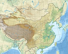
Location map of China.
EquiDistantConicProjection : Central parallel :
* N: 36.0° N
Central meridian :
* E: 104.0° E
Standard parallels :
* 1: 30.0° N
* 2: 42.0° N
Latitudes on the central meridian :
* top: 57.0° N
* center: 37.29° N
* bottom: 17.96° N
Made with Natural Earth. Free vector and raster map data @ naturalearthdata.com.
Autor: ignat, modified by Rupert Pupkin, Licencja: CC BY 2.5
Flight over himalaya to Lhasa, Khumbu region, many eight-thousanders are visible: Makalu, Everest, Lhotse, Cho Oyu, Shishapangma, Manaslu, + 7000ers Chamlang, Baruntse, Chomo Lonzo. To the left of Manaslu in the distance and unlabelled there are (probably) Ngadi Chuli and Himal Chuli (behind the Chamlang-arrow); they were formerly identified as Annapurna and Dhaulagiri but this was proved false; also in the picture but unlabelled: Nuptse (left of Lhotse, below Cho Oyu) and Cho Polu (below Lhotse, right of Baruntse)


