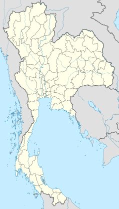
Chumphon
| Ten artykuł od 2014-04 wymaga zweryfikowania podanych informacji. |
 | |
| Państwo | |
|---|---|
| Prowincja | |
| Amphoe | Mueang Chumphon District |
| Populacja (2005) • liczba ludności |
|
| Kod pocztowy | 86000 |
| Strona internetowa | |
Chumphon lub Czumfon (tajs. ชุมพร) – miasto w południowej Tajlandii. Siedziba administracyjna prowincji Chumphon i dystryktu Mueang Chumphon, 463 km od Bangkoku.
Podstawowym źródłem utrzymania mieszkańców jest rolnictwo, mniej turystyka. W 1989 roku w Czumfonie wiele szkód wyrządził tajfun.
Linki zewnętrzne
- Chumphon. moohin.com. [zarchiwizowane z tego adresu (2013-02-27)].
Media użyte na tej stronie
The national flag of Kingdom of Thailand since September 2017; there are total of 3 colours:
- Red represents the blood spilt to protect Thailand’s independence and often more simply described as representing the nation.
- White represents the religion of Buddhism, the predominant religion of the nation
- Blue represents the monarchy of the nation, which is recognised as the centre of Thai hearts.
Autor: Media lib, Licencja: CC BY-SA 3.0
Sao Lak Mueang Chumphon (City Pillar Shrine)
Autor: Media lib, Licencja: CC BY-SA 3.0
National Museum Chumphon, Thailand


