Cieśnina Magellana
| ||
 Zdjęcie satelitarne Cieśniny Magellana | ||
| Państwo | ||
| Akweny • Łączy wody • Z wodami | Oceanu Atlantyckiego Oceanu Spokojnego | |
| Lądy • Oddziela • Od | Amerykę Południową Ziemi Ognistej | |
| Wymiary • długość • szerokość | 550 km 2,2–45 km | |
| Głębokość • maksymalna | 1180 m | |
| Miejscowości nadbrzeżne | Punta Arenas | |
| 53°28′51″S 70°47′00″W/-53,480833 -70,783333 | ||
Cieśnina Magellana (hiszp. Estrecho de Magallanes) – cieśnina pomiędzy kontynentem Ameryki Południowej, Wyspami Królowej Adelajdy, wyspą Riesco a wyspami Ziemi Ognistej, łącząca Ocean Atlantycki z Oceanem Spokojnym.
Długość ponad 550 km, szerokość 2,2–45 km, maksymalna głębokość – 1180 m, rozwinięta linia brzegowa (wysokie, skaliste brzegi, liczne wyspy, półwyspy i zatoki). Główny port – Punta Arenas na półwyspie Brunswick.
Cieśnina Magellana stanowi międzynarodowy szlak żeglugowy – oznacza to, że rząd Chile nie może ograniczać swobody żeglugi na tym akwenie; kursowanie statków utrudniają liczne mielizny i skały podwodne, porywiste wiatry zachodnie, silne pływy (12 m u wejścia z Atlantyku, 2,1 m u wyjścia na Pacyfik) i prądy pływowe.
Cieśninę nazwano na cześć Ferdynanda Magellana, który odkrył ją i przepłynął w 1520 roku podczas podróży dookoła świata (nazwał ją wówczas, na pamiątkę wpłynięcia w nią 1 listopada, Cieśniną Wszystkich Świętych).
Cieśnina straciła na znaczeniu żeglugowym po wybudowaniu Kanału Panamskiego. W 1881 roku status prawny cieśniny został określony w bilateralnym traktacie Argentyna-Chile. Traktat wprowadzał następujące zasady:
- wolność żeglugi zarówno dla statków handlowych, jak również okrętów wszystkich bander w dzień i w nocy, w czasie pokoju i w czasie wojen
- demilitaryzacja cieśniny
- neutralizacja cieśniny
Status prawny cieśniny ewoluował, gdyż oba państwa 10 grudnia 1941 roku podpisały kolejny traktat, uchylając zasadę neutralizacji i wprowadzając zakaz żeglugi w nocy. Po zakończeniu wojny nastąpił powrót do statusu quo ante. Cieśnina o statusie specjalnym w zasadzie w najszerszym zakresie uwzględnia interesy żeglugi.
Zobacz też
Media użyte na tej stronie
Autor:
- Chile_location_map.svg: NordNordWest
- derivative work: Виктор В (talk)
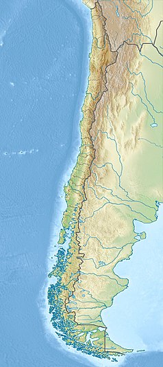
Location map of Chile
Łatwo można dodać ramkę naokoło tej grafiki
Straits of Magellan (June 21, 2004) - The Nimitz-class aircraft carrier USS Ronald Reagan (CVN 76) cruises through the Straits of Magellan on her way to the Pacific Ocean. Reagan is underway circumnavigating South America in transit to her new homeport of San Diego, Calif., while participating in exercises supporting Summer Pulse 2004. Summer Pulse 2004 is the simultaneous deployment of seven aircraft strike groups (CSGs), demonstrating the ability of the Navy to provide credible combat across the globe, in five theaters with other U.S., allied, and coalition military forces. Summer Pulse is the Navy’s first deployment under its new Fleet Response Plan (FRP). U.S. Navy photo by Photographer's Mate 3rd Class Elizabeth Thompson (RELEASED)For more information go to: <a href="http://www.cffc.navy.mil/summerpulse04.htm" Target="_BLANK">www.cffc.navy.mil/summerpulse04.htm</a>
Autor: Miguel Vieira, Licencja: CC BY 2.0
Commerson's dolphins (Cephalorhynchus commersonii) in the Strait of Magellan
Until the Panama Canal was finished in 1914, the Strait of Magellan was the only safe way to move between the Atlantic and Pacific Oceans. Protected by the Tierra del Fuego to the south and the bulk of South America to the north, ships crossed in relative ease, removed from the dangers of Drake Passage. Drake Passage is the relatively narrow stretch of ocean separating South America from Antarctica, the waters of which are notoriously turbulent, unpredictable, and frequented by icebergs and sea ice. In this unusually clear true-color Moderate Resolution Imaging Spectroradiometer (MODIS) image, the entire Strait is visible. The eastern opening is the wide bay on the border of Chile and Argentina. To the west, there are a number of access points from the Pacific, though the most easily seen here is the roughly 200 km stretch from the Queen Adelaide Archipelago (at center left) to the bulk of the Strait (at lower center). The islands and mountains are highlighted by bright white snow, while the lower-elevation lands to the north and east remain clear. This image was acquired by the Aqua satellite on August 27, 2003.
Autor: Szczureq, Licencja: CC BY-SA 4.0
Mapa lokalizacyjna regionu Magallanes w Chile
Autor: Magallanes1, Licencja: CC0
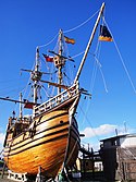
Replica de la Nao Victoria de Hernando de Magallanes en la ciudad de Punta Arenas
Autor:
- Sur2.gif: Createaccount
- derivative work: Createaccount
Big Map of southern Chile: From Straits of Magellan to Cape Horn
Autor: Gonce, Licencja: CC BY-SA 3.0
Ferry que comunica Tierra del Fuego con América


